
Lake Basin, Dumbbell Lakes, and Amphitheater Lake
Trip Breakdown
Difficulty Rating: Hard Days/Nights: 5/4 Distance: 50.98 mi
Elevation Range: 5,426' to 12,087' Total Elevation Gain/Loss: +15,238'/-15,236'
Time of Year: Early September 2023 Snowpack: 296% (Southern Sierra - Record snowpack)
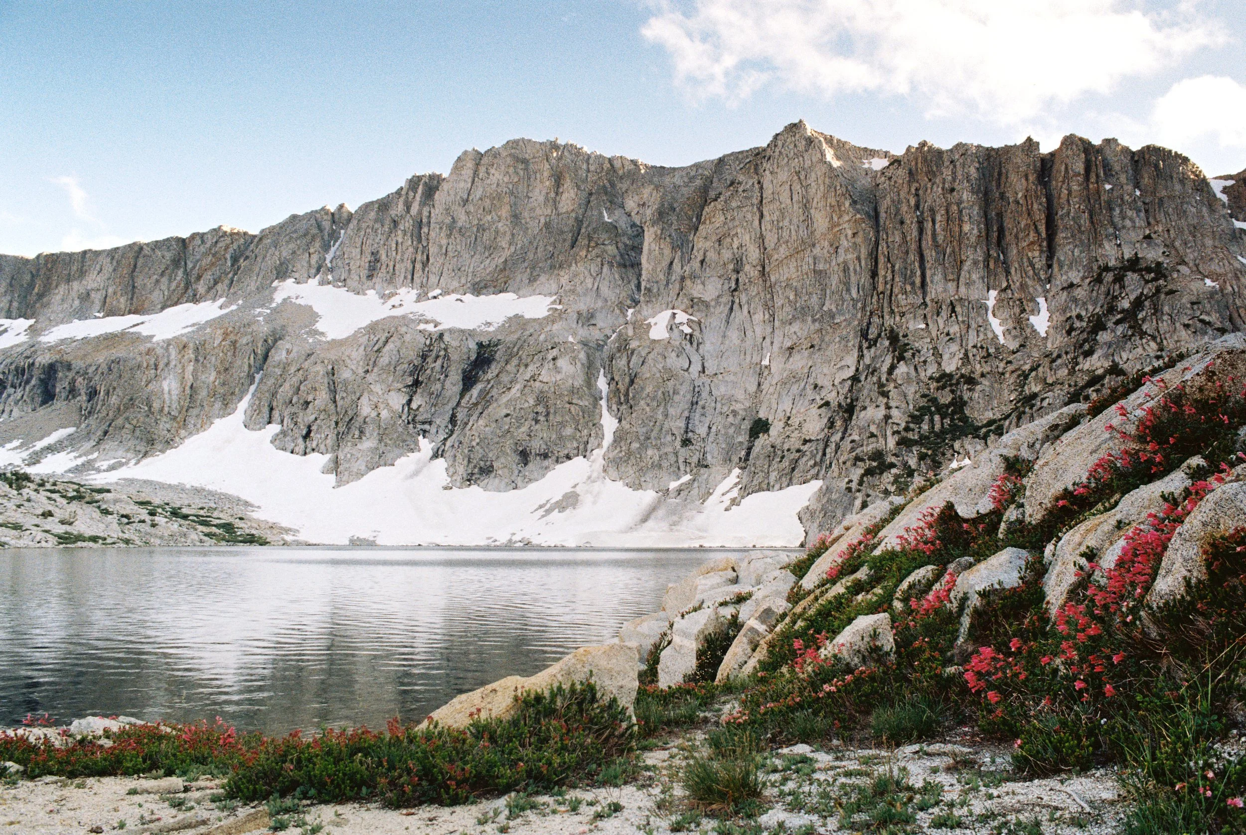
The Good: Amphitheater Lake
The Bad: Old John Muir Trail; Cataract Creek Pass (off-trail pass)
Marmot sightings: 0
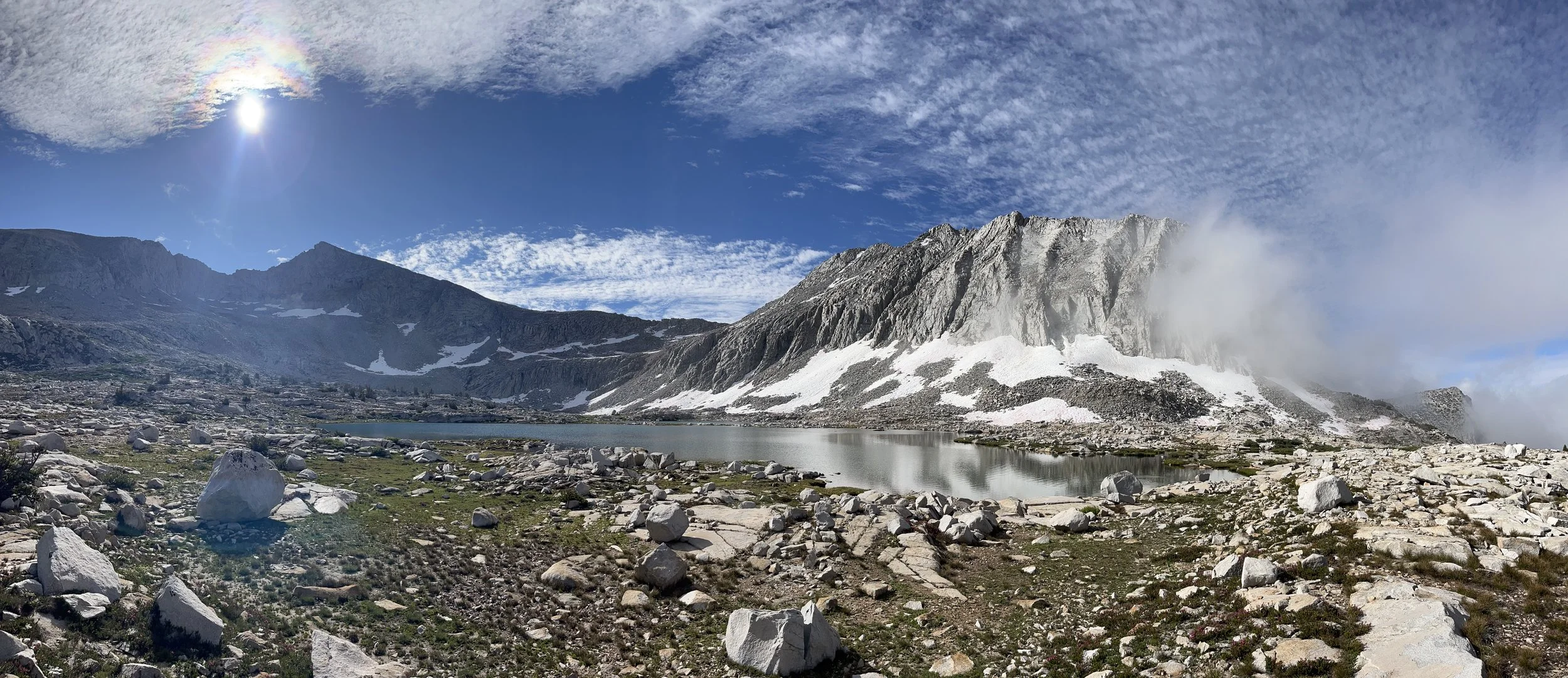
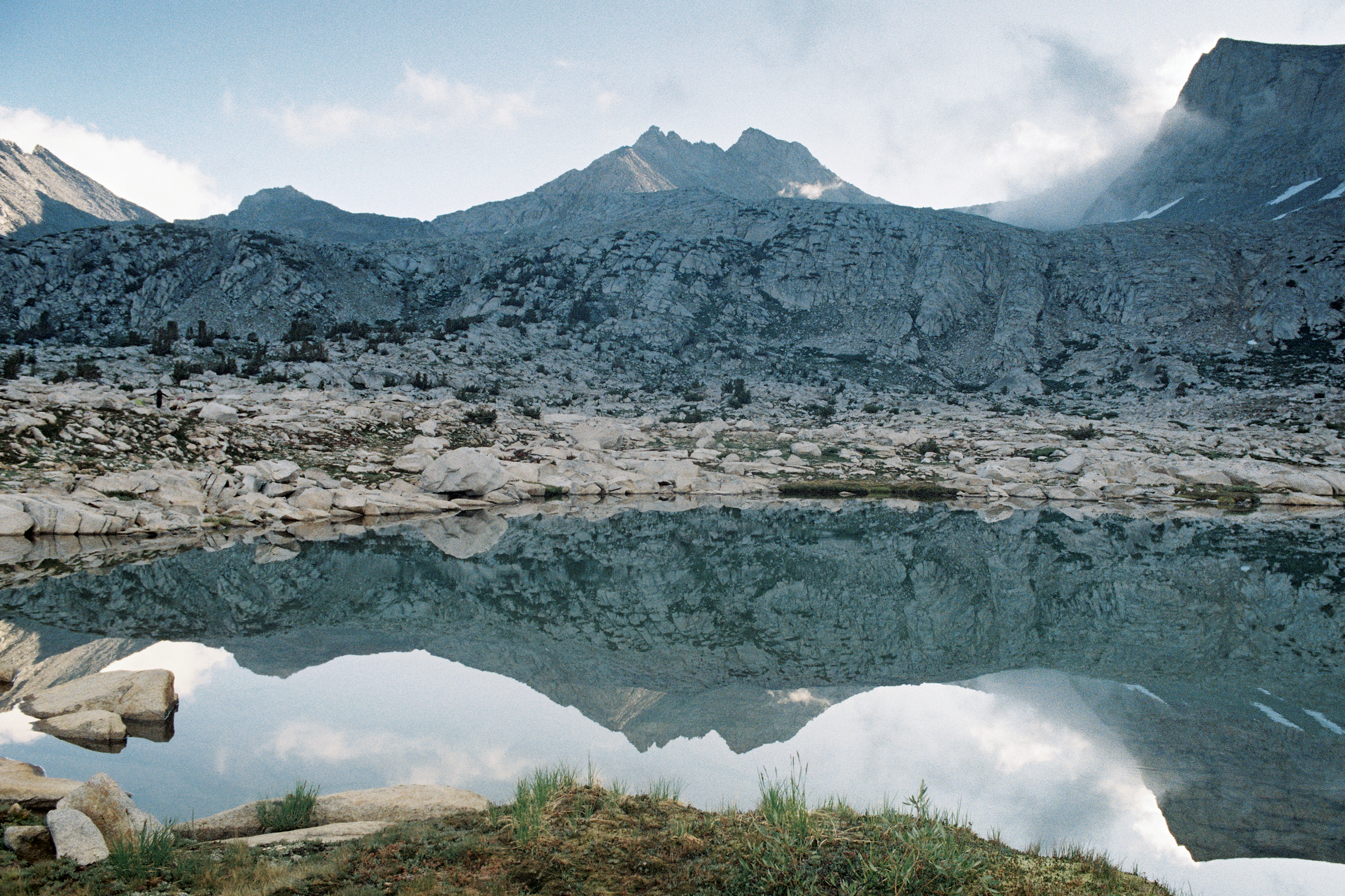
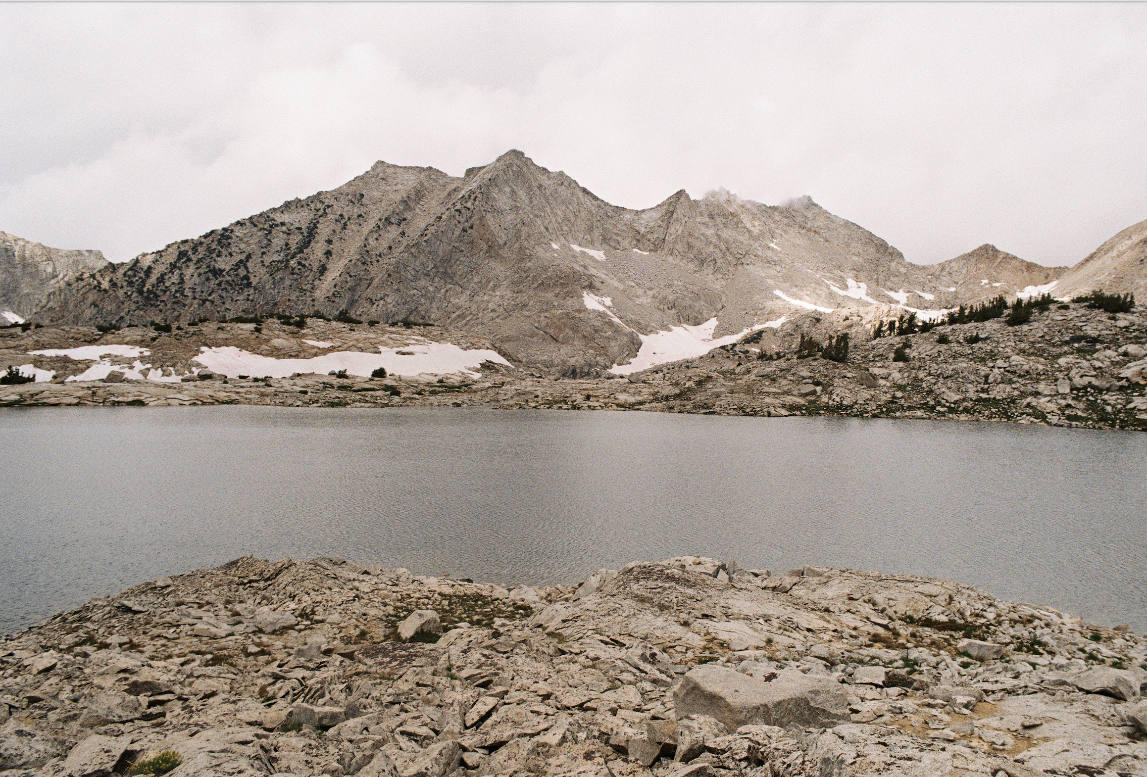
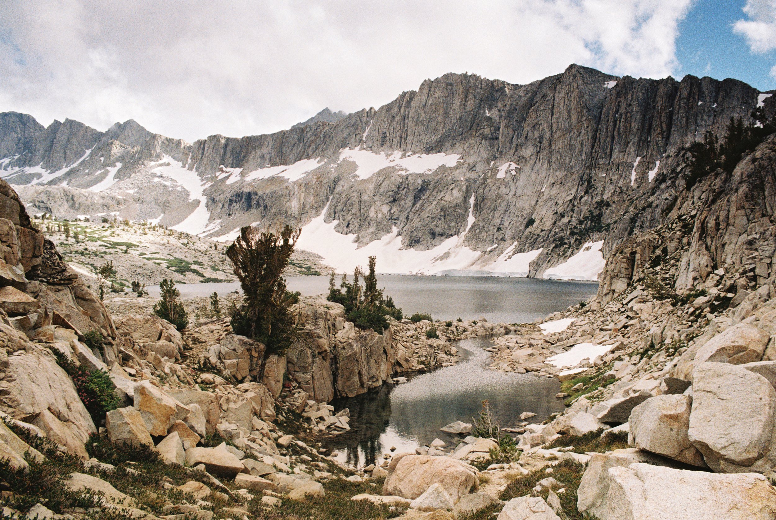
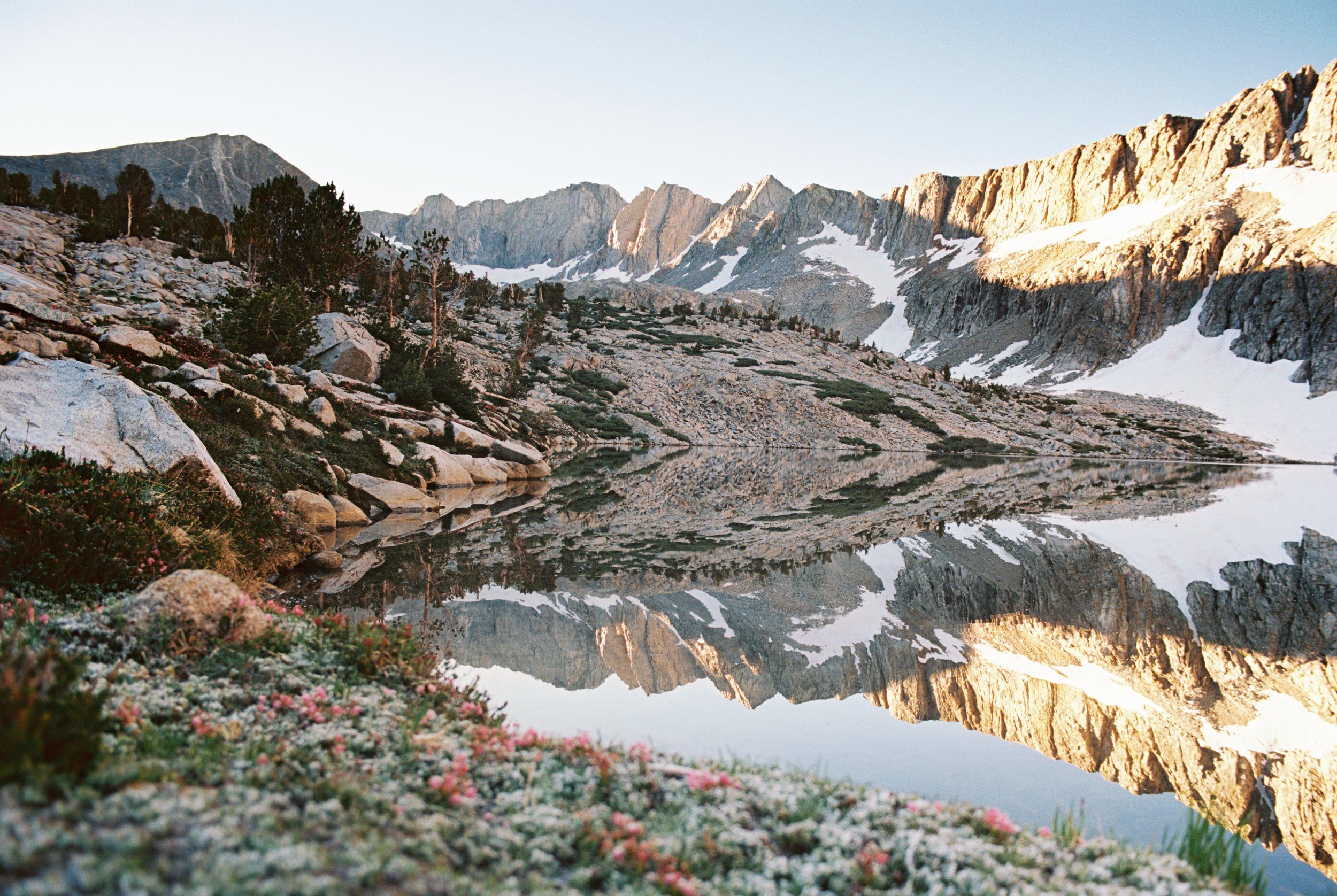
Lake Basin.
A Brief Trail Preview
On the east side of the Sierra Nevada there are four notorious passes lovingly referred to as the “Four Nasty Passes”, each climbing upwards of 5,500 feet from their trailhead to its pass. These include Baxter Pass, Sawmill Pass, Shepard Pass, and Taboose Pass.
Taboose Pass trail starts in the high-elevation, semi-arid desert of the Owens Valley (5,400') and ascends 6,000 feet in 6.5 miles up Taboose Creek Canyon to the pass (11,400'). The trail offers a tough route to scenic Bench Lake, which sits ~1.7 miles off of the John Muir Trail (JMT).
For this trip, we made a clockwise loop using portions of the old JMT and several off-trail passes (Cartridge, Dumbbell, Cataract Creek) to reconnect with the JMT along Palisade Creek, crossing Mather Pass before eventually exiting via the Taboose Pass Trail. Highlights of the route included the remote basins and lakes we passed through—Lakes Basin, Dumbbell Basin, and Amphitheater Lake.
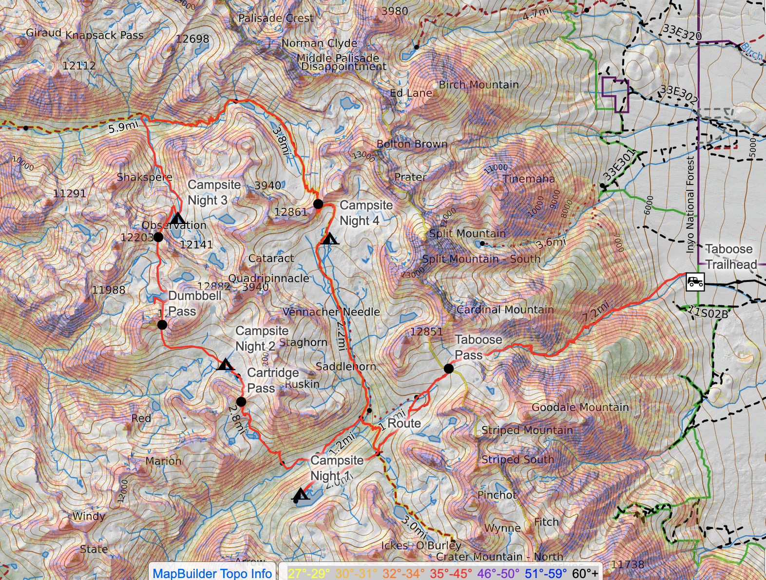
Trail Diary
After a night camping at Taboose Creek Campground, we made our way along the rough Taboose Creek Road to the trail head. The access road has some washed out areas blocked off by LA Department of Water and Power and it gets a bit rough towards the end but nothing a 2WD vehicle can’t handle. We failed at getting an early start and ended up hitting the trail around 10 a.m., which is not recommended for the hot, shadeless climb out of the Owens Valley.
The trail keeps you north of Taboose Creek for a few miles before you encountered the first of two major creek crossings. We crossed paths with a solo hiker on our way up who had decided to turn around at the creek because she had felt too uncomfortable to cross it alone. We offered to cross with her, but she had already made up her mind. We parted ways, left wondering what might lie ahead.
The first creek crossing was washed out but manageable. The second crossing, which sits below a small waterfall, gave us pause. The exceptional snowfall of the winter of 2022/2023 made for a late backpacking season in the Sierra and the creeks were still running high even in September. The whitewater below the falls was raging, and a large tree had fallen directly across the middle of the crossing. We now understood our trail buddy’s apprehension.
Someone had strung a paracord line between trees on both sides of the creek, but it sagged so much that it offered little assistance. After some deliberation, we decided to proceed. The rocks above the waterline were slippery and the tree branches kept catching on our packs as we crossed, but we made it. Soaked to the waist and a bit rattled by the risky crossing, I was not looking forward to re-crossing the creek on the way out.
Unfortunately for us, the afternoon weather began to take a turn. As we began climbing talus switchbacks towards the pass, the late afternoon winds began to pickup. We put our heads down and pushed on until the wind began to literally pushback. I had to start crouching during gusts to keep from falling over with my top-heavy pack. To add insult to injury, it started hailing. We hiked in bursts when the wind died back and sat down when we couldn’t stand as we slowly made our way to the pass at ~11,300 ft.
A Note on Taboose Pass Anthropology
Taboose Pass served as a summer trade route between the Paiute people of the Owens Valley and the Western Mono and Yokuts groups to the west. Obsidian fragments and rock ring features can still be found in the area, but hikers should leave these artifacts undisturbed if encountered.
The storm didn’t let up as we began the gradual westerly descent towards the JMT. At the junction with the JMT, we continued west to Bench Lake, our destination for the night. At this point we were cold, wet, and completely wiped out as we looked for a dry place to pitch our tent.
The next morning we woke up to low-hanging clouds over the lake, which created a moody atmosphere while we packed up camp. We backtracked a few miles to the junction of the JMT and the weather began to clear. Now we just needed to locate the faint turn off onto the old JMT.
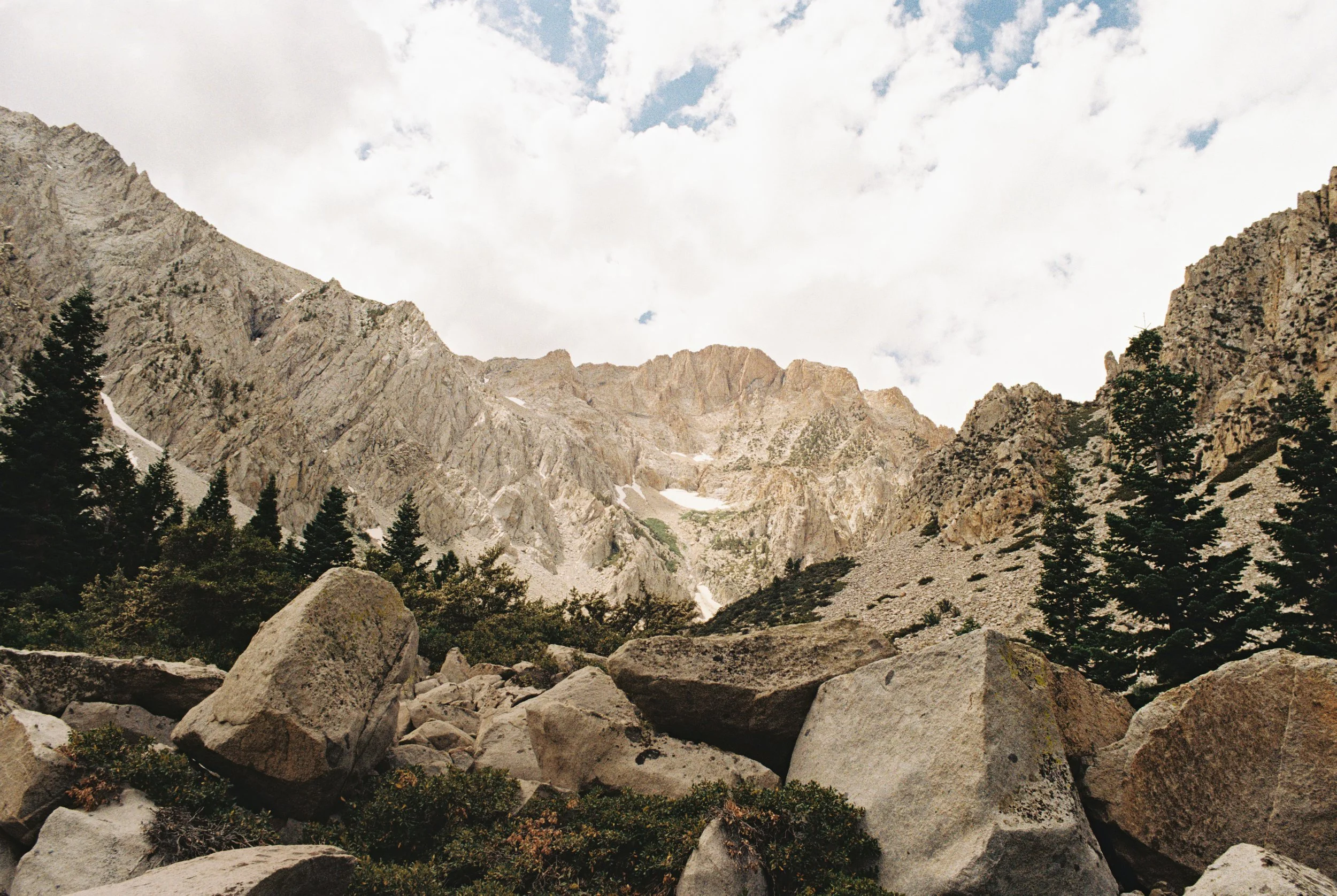
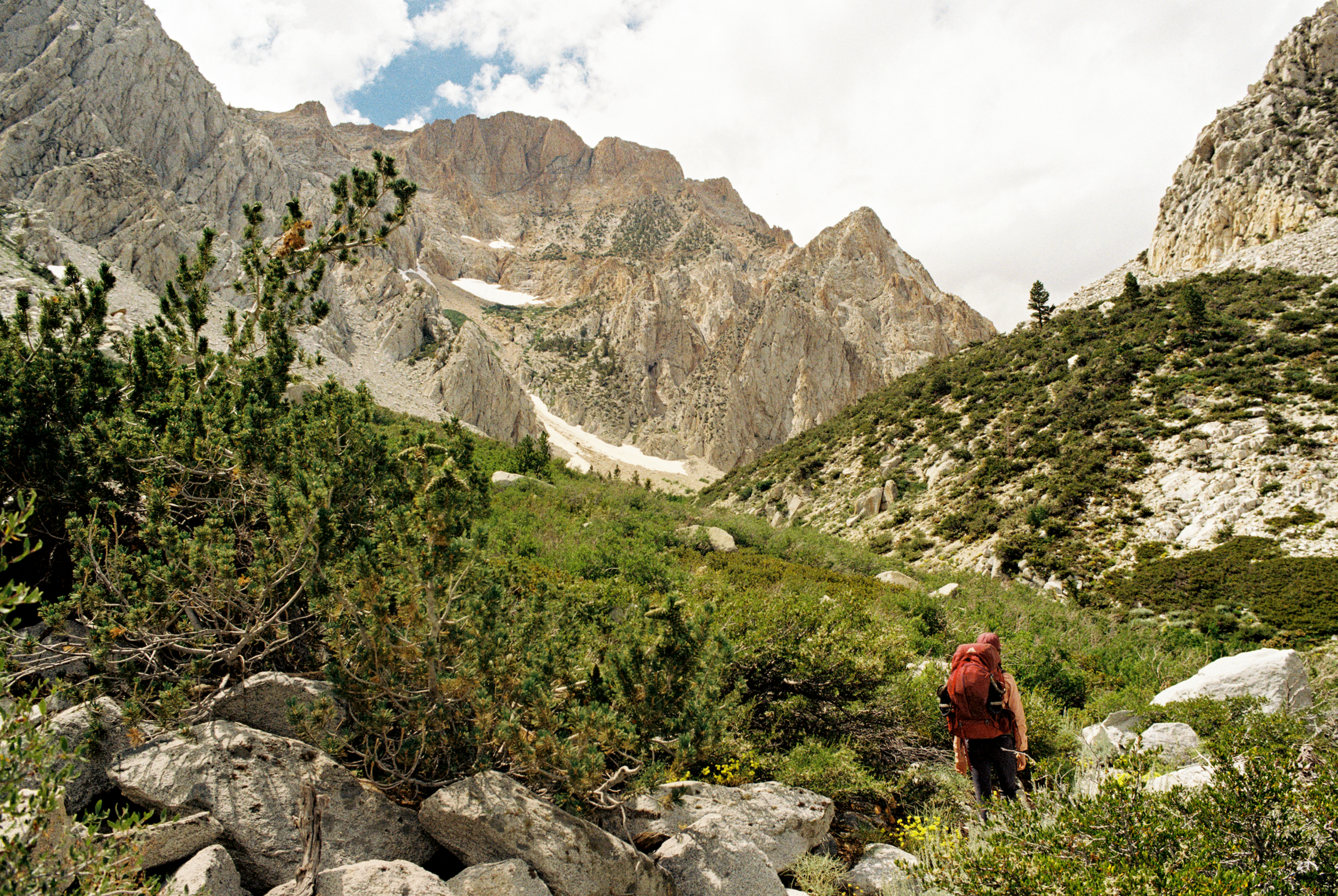
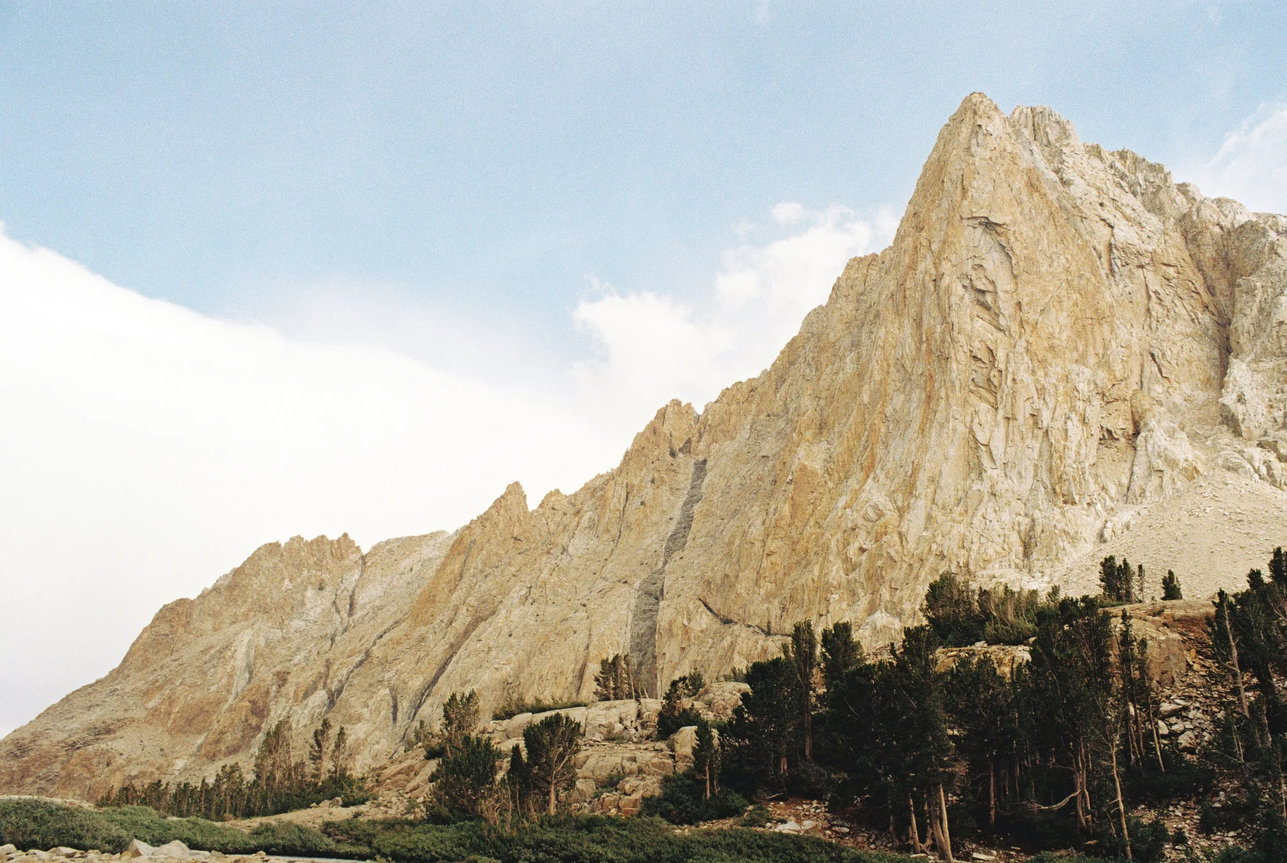
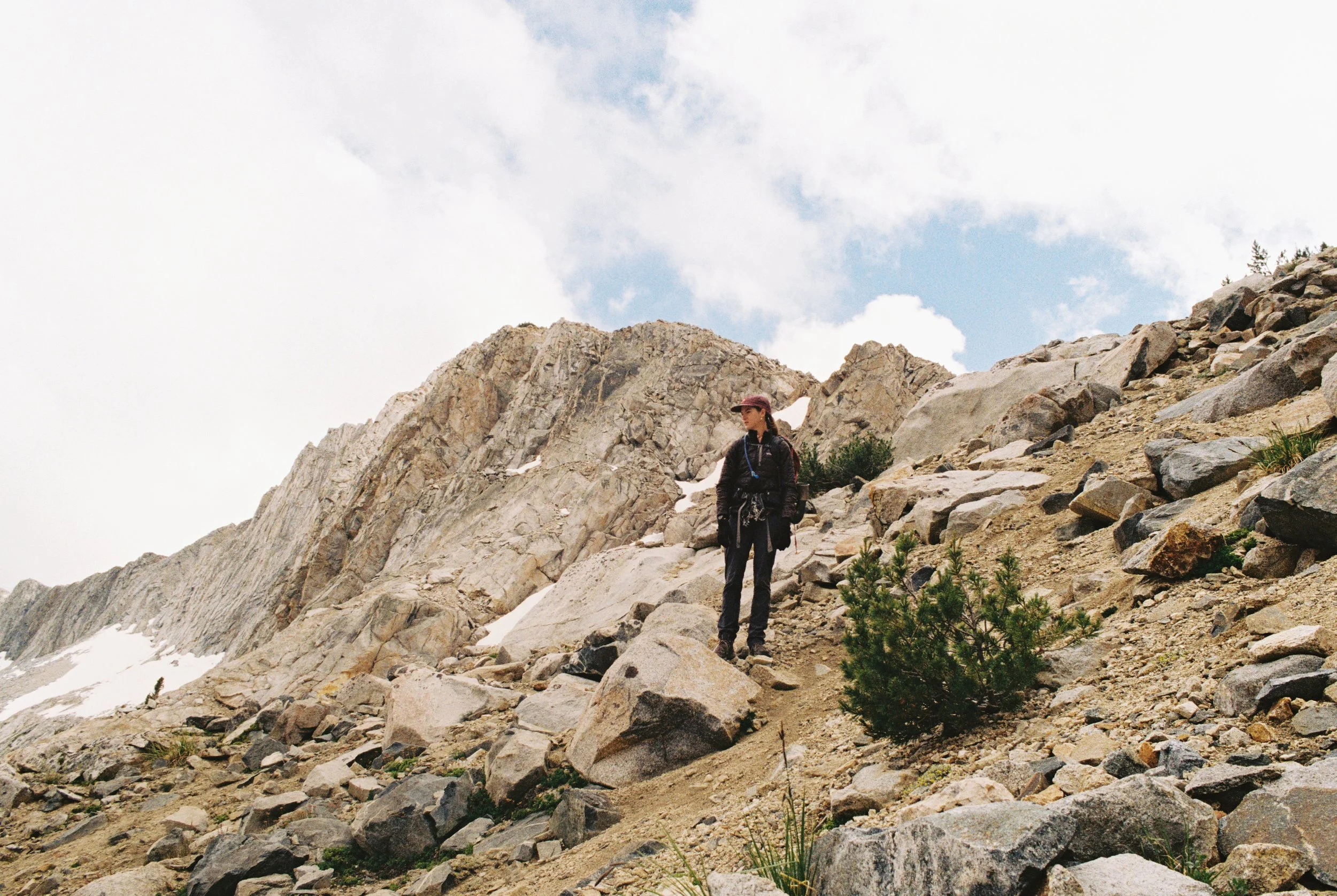
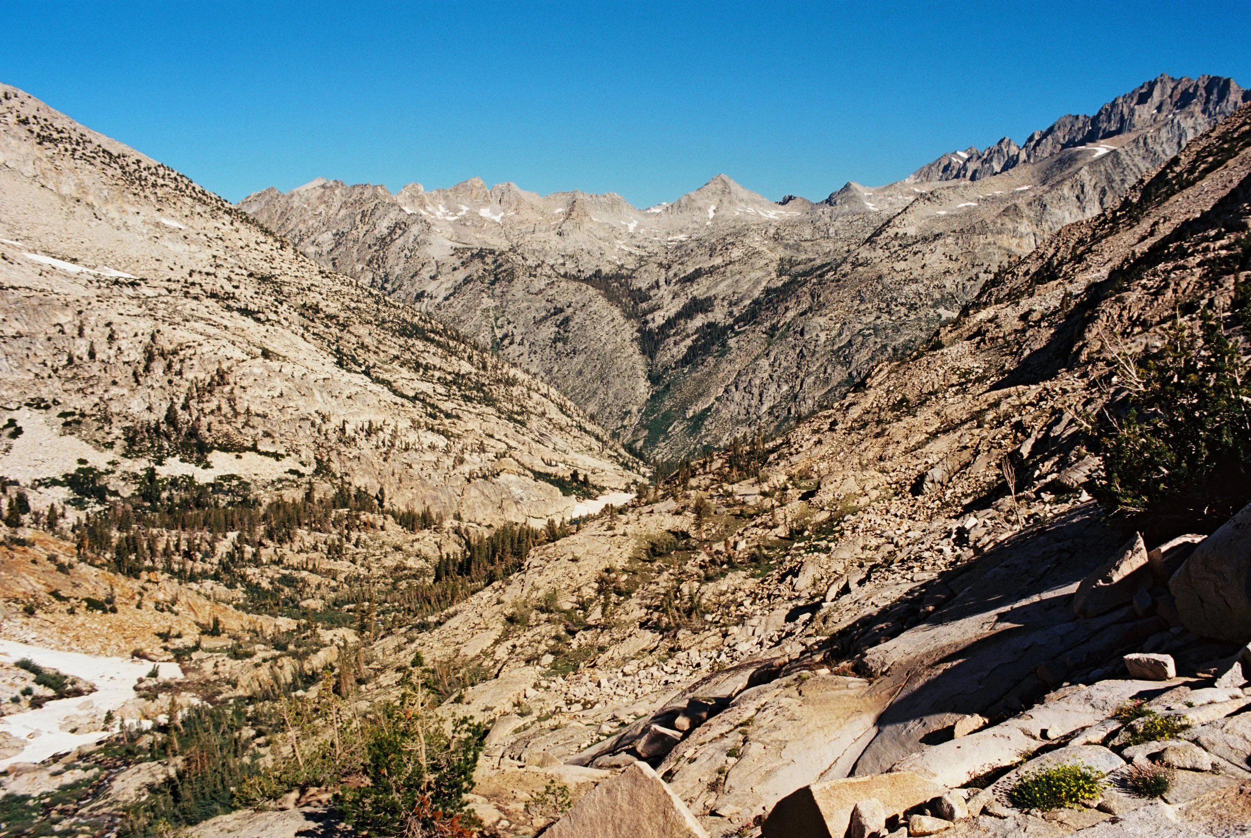
This old portion of the JMT is an old sheep route that was used until Mather Pass was completed in 1937 and hasn’t been maintained for almost 90 years. The “trail” follows the South Fork Kings River and is very overgrown and is considered difficult cross-country travel. Along the river, you have two options: bushwhack along the south side or talus-hop along the north to avoid the overgrowth. Neither are great. Eventually, the trail diverges from the river and begins climbing the north side via steep, eroded switchbacks to Cartridge Pass (~11,700 ft).
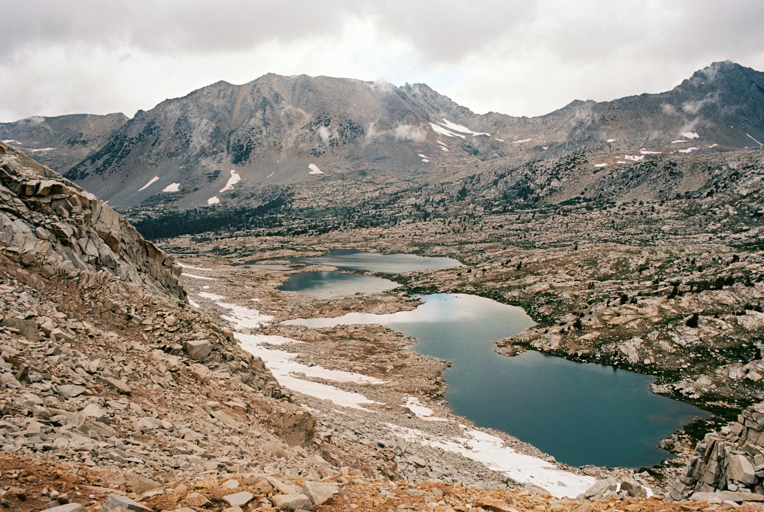
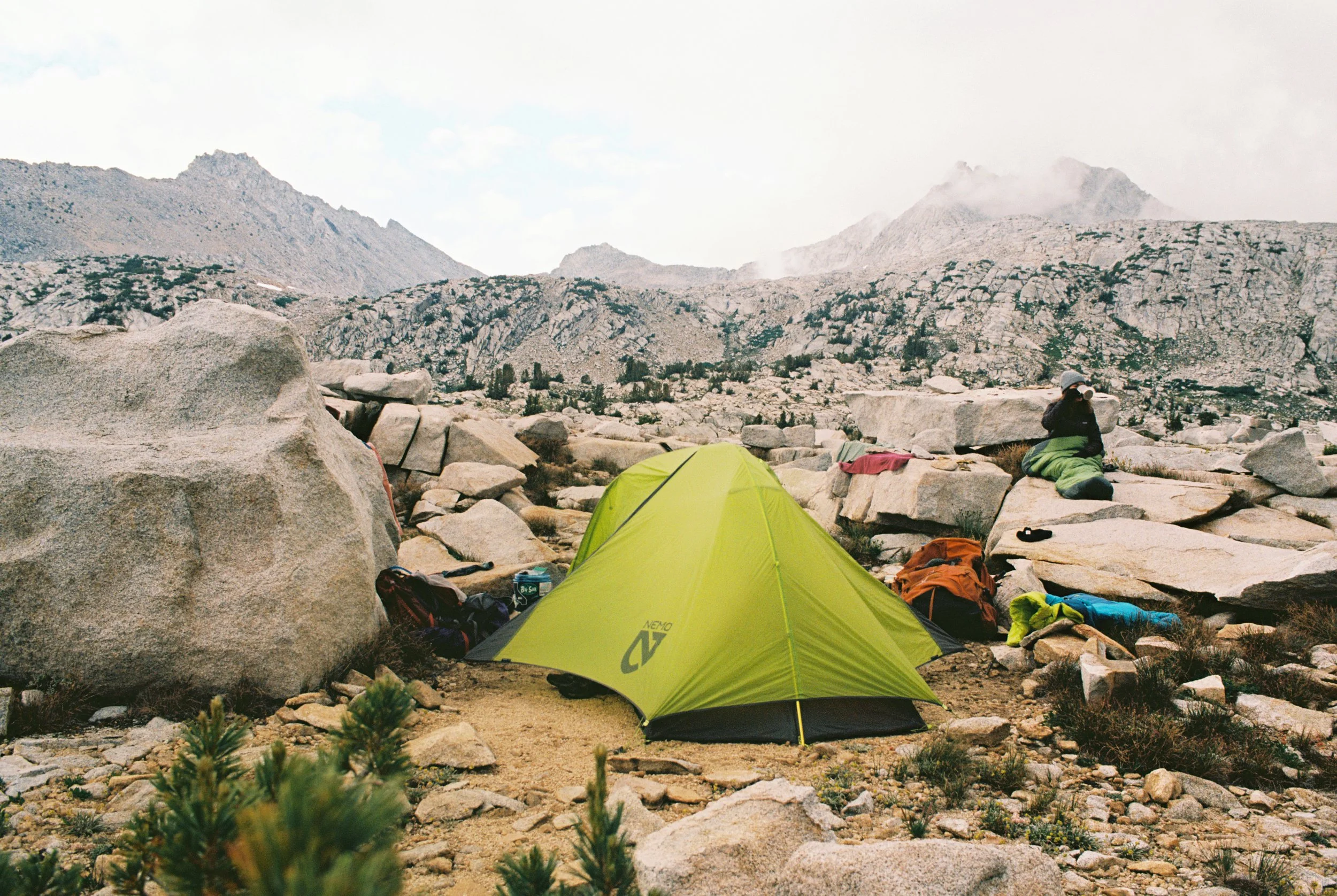
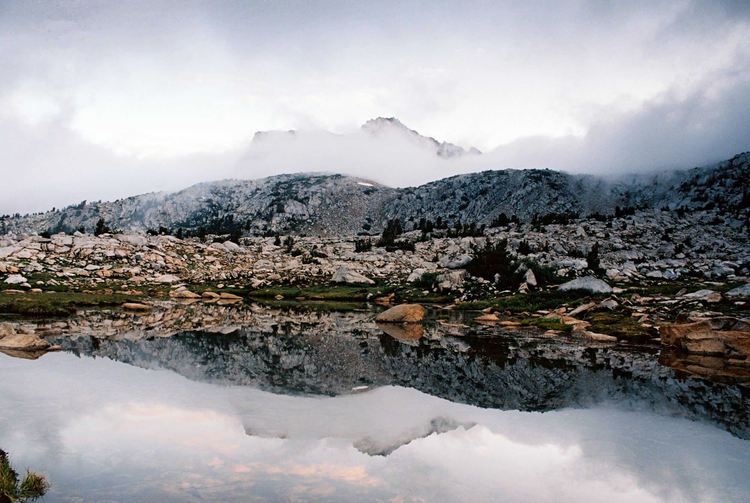
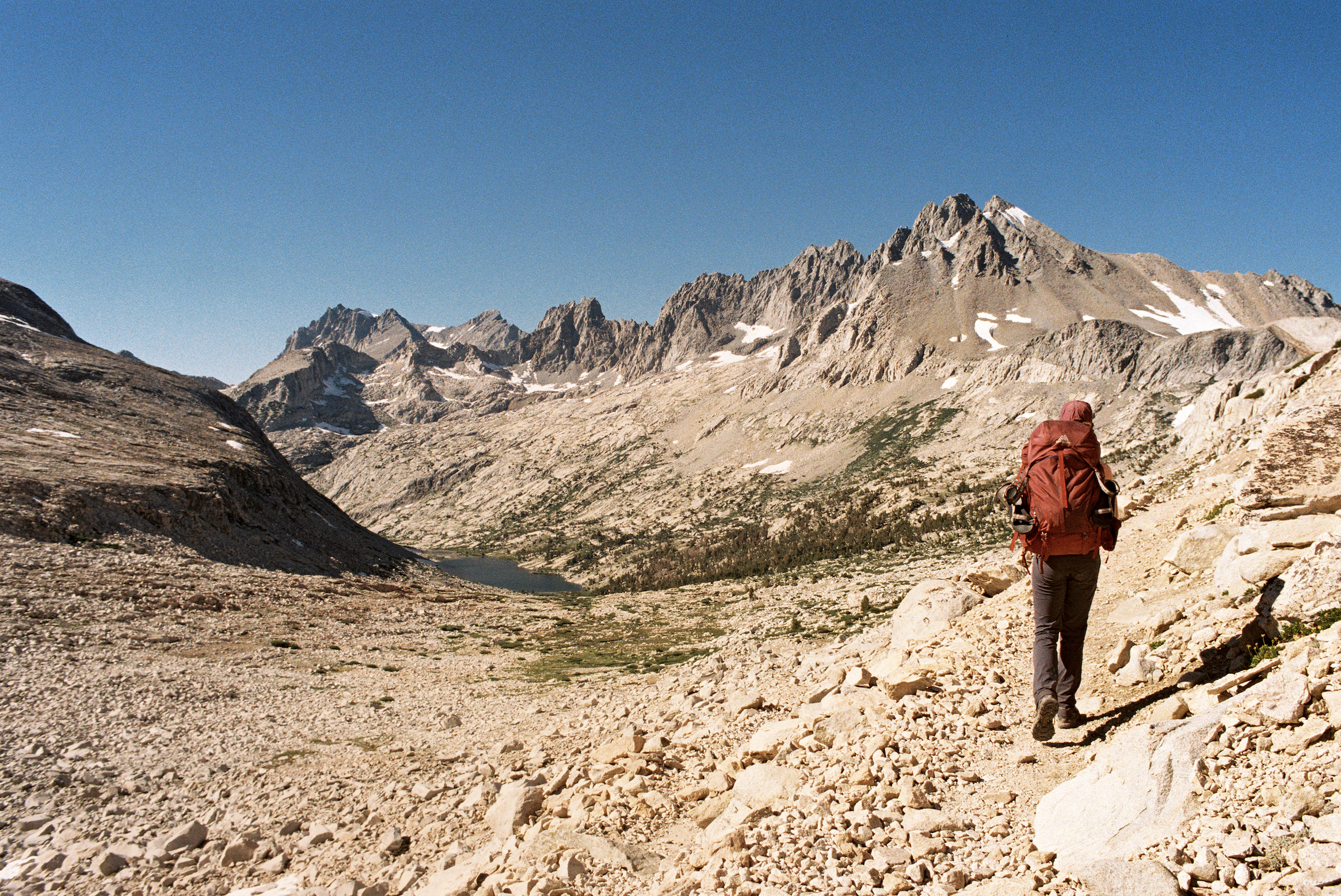
After cresting, we dropped down and aimed for the lowest lake in Lake Basin. We followed a faint path to the end of the third lake and set up camp on a bench overlooking a valley. We had the basin to ourselves that night—pure bliss. If I had to rank Sierra basins, Lake Basin would score quite high.
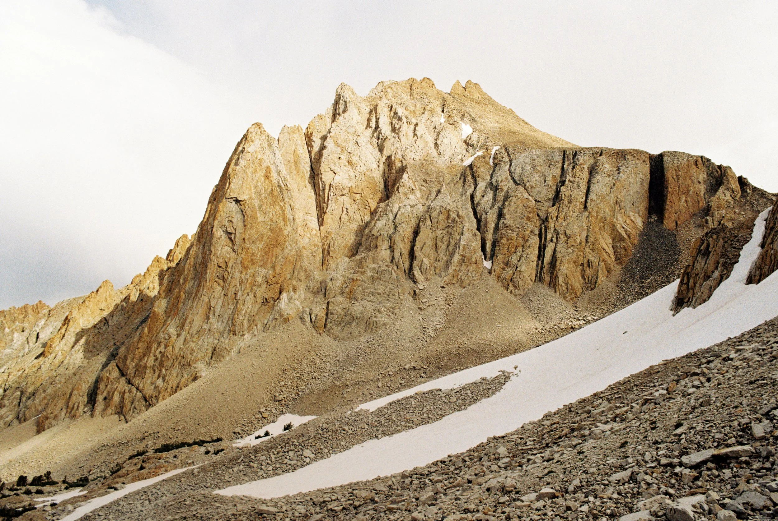
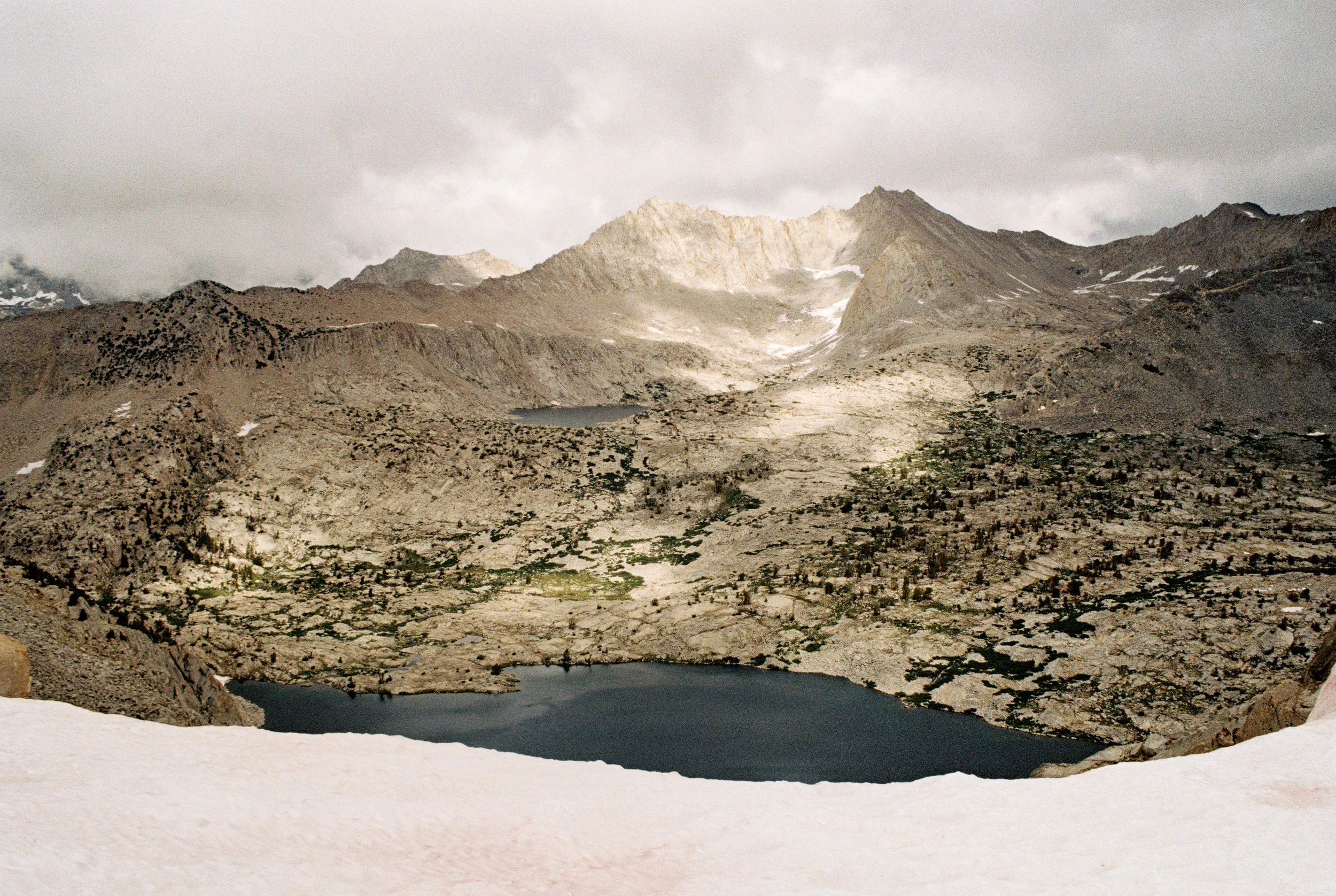
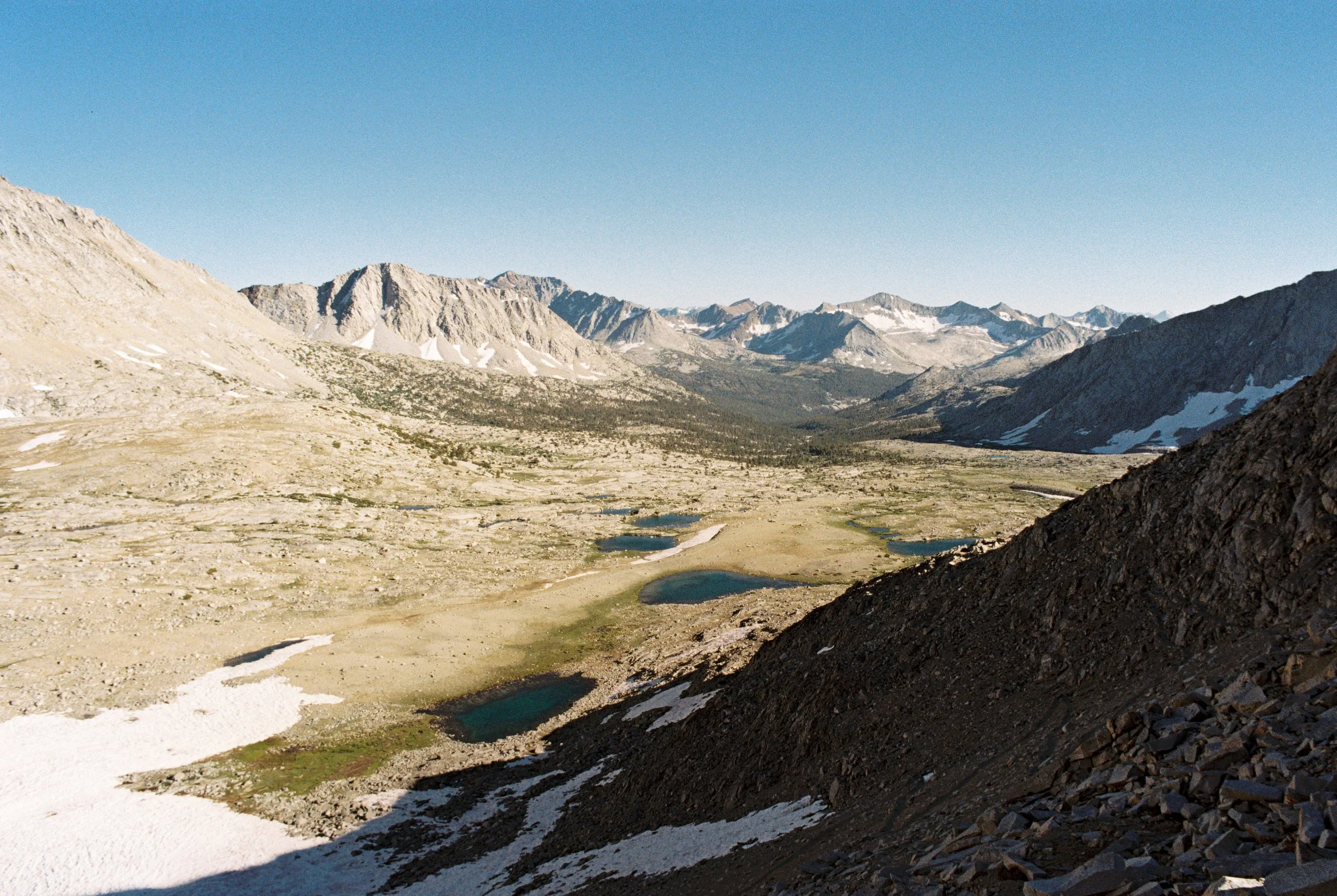
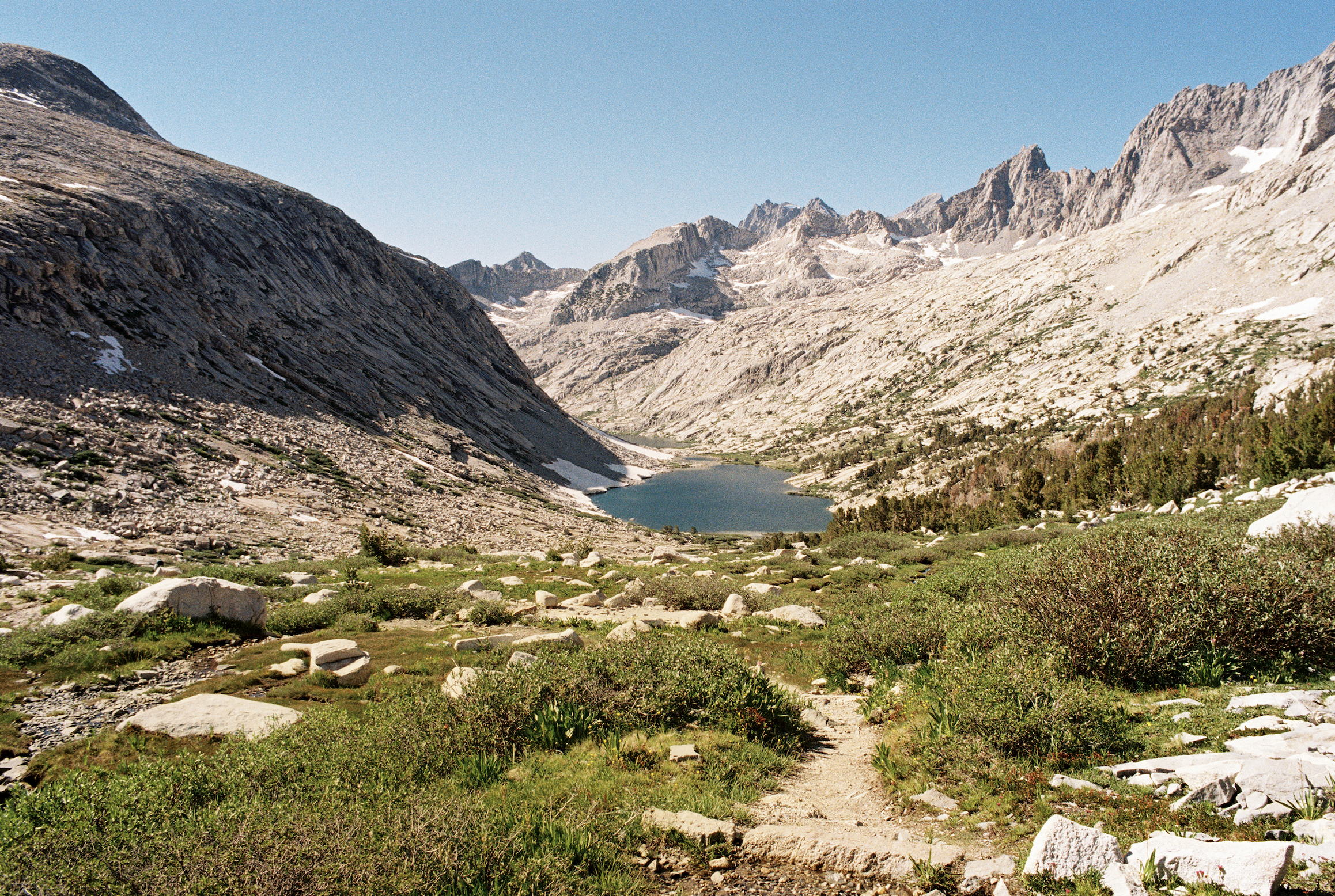
The next day we continued northwest toward Dumbbell Pass (Class 2), crossing relatively easy grassy terrain before stopping for lunch and putzing around the Dumbbell Lakes. Afterward, we circled east around the first “dumbbell” and set our sights on the next backcountry pass of the day: Cataract Creek Pass.
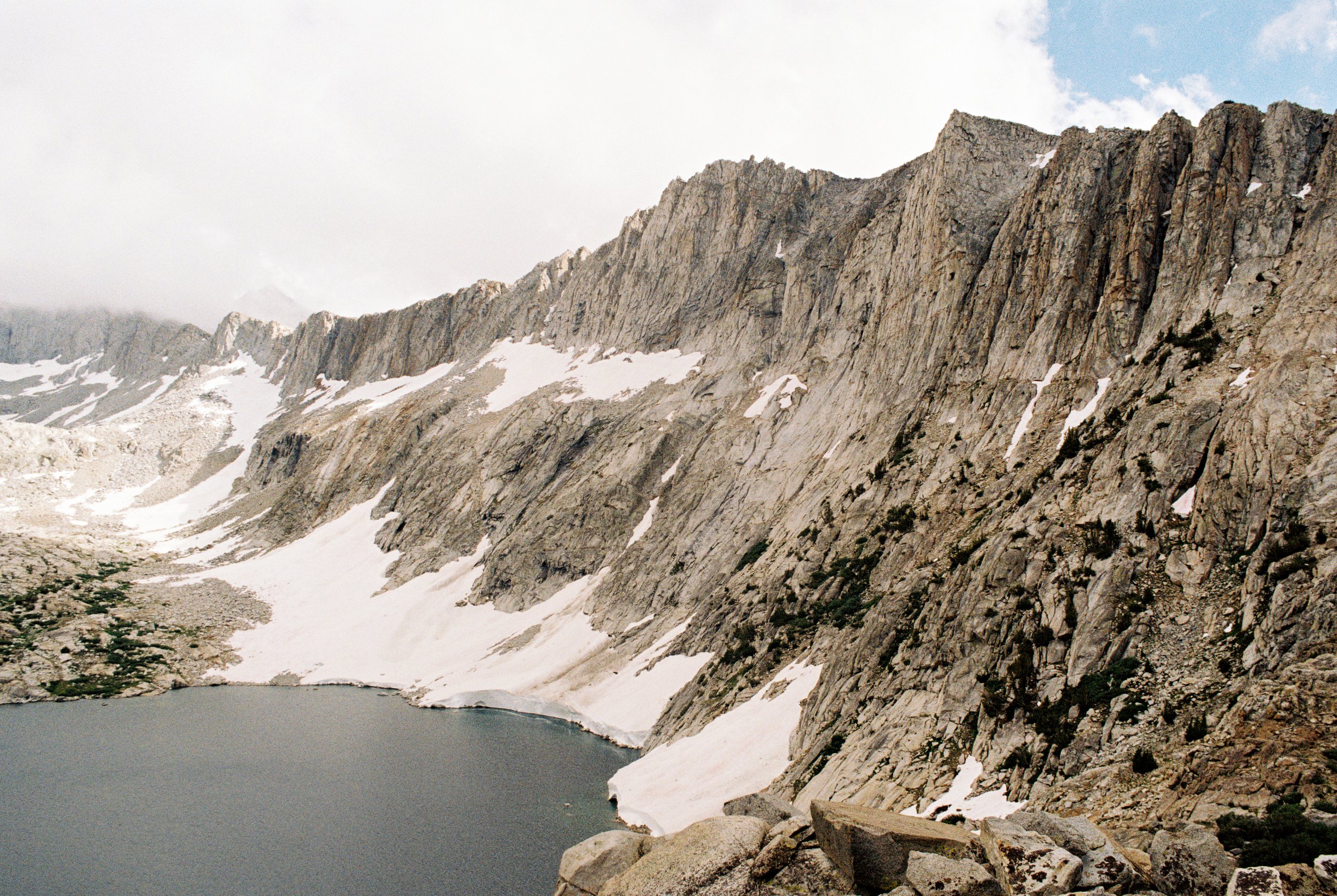
The approach from Dumbbell Lakes was a piece of cake but the descent to Amphitheater Lake was anything but. Our guidebook classifies Cataract Creek Pass as Class 2, but I would argue that the rating is very condition-dependent. Based on our research, we knew Cataract Creek Pass often holds a cornice and can be tricky to navigate (thanks, High Sierra Topix users), but the heavy snowpack made it a different beast altogether.
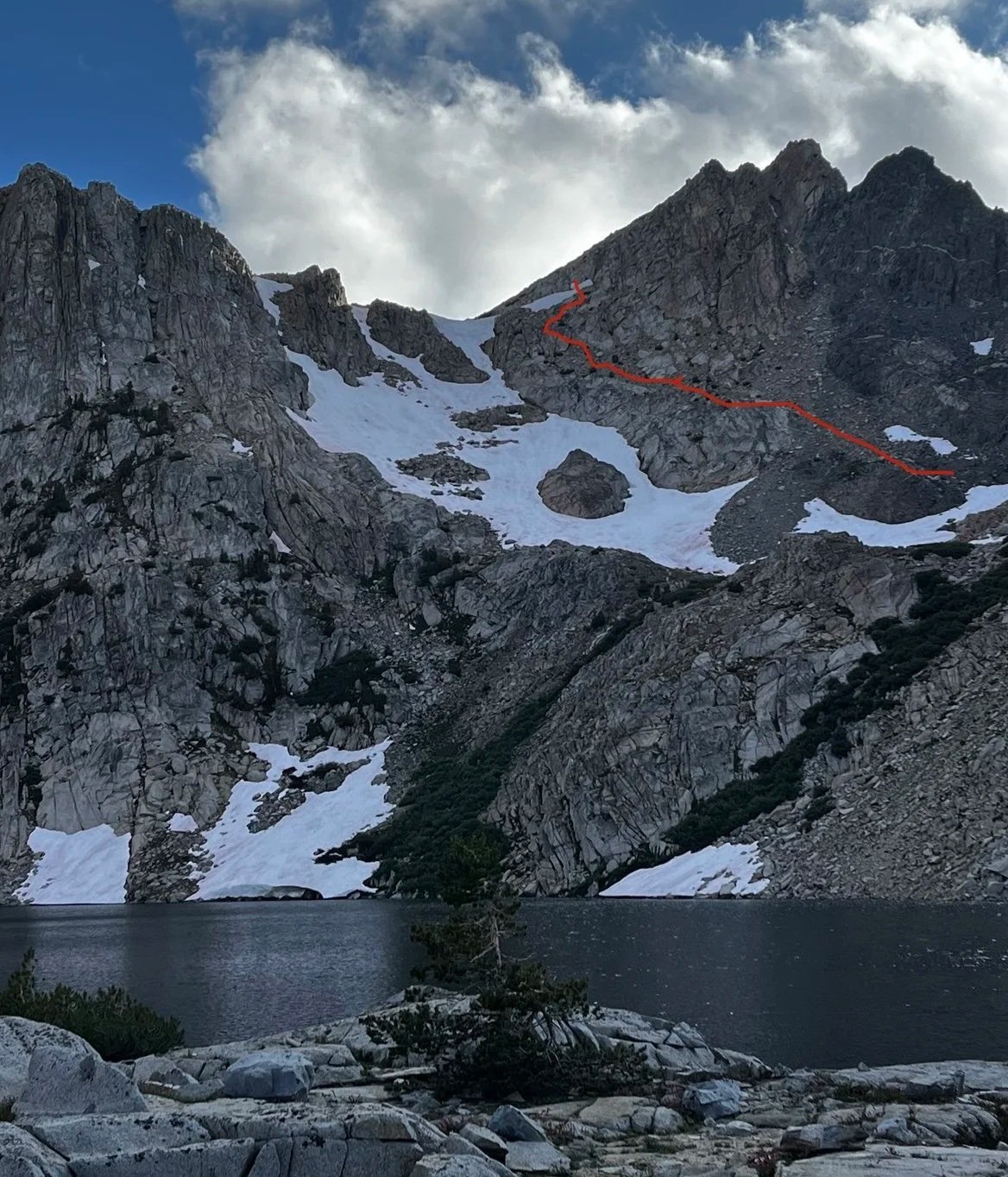
Roughly drawn route down from Cataract Creek Pass.
The cornice was indeed there, hanging over a steep drop to the talus below. We considered climbing above the pass’s low point to bypass the cornice, as our guidebook suggested, but given the conditions the safest option was to go straight through.
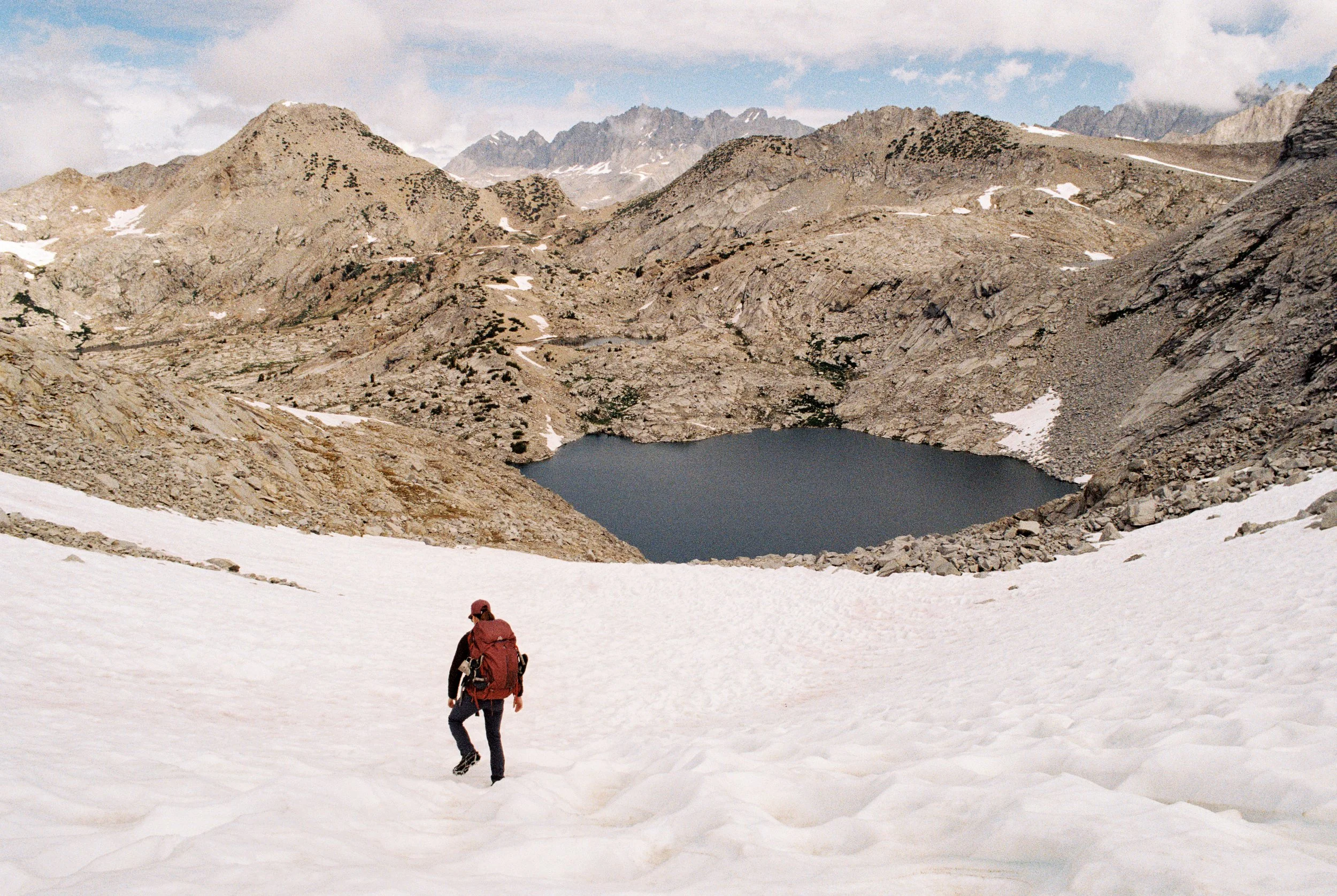
We removed our packs. Tanner butt-slid down the snowy slope first. I sent the packs down after him, then followed. When the snow suddenly turned to rock below, I had to dig in my heels to stop.
Thinking the worst was behind us, we began descending the scree. This is where the heart rate really began to pick up. The scree chutes were narrowly confined between bulging outcrops and incredibly loose. With few secure pathways, we did our best to keep a slow, controlled pace while carefully selecting our routes down. After a few uncontrolled slides in terrain with little margin for error, I had already renamed the pass “Cardiac Creek” in my head.
We continued our northwesterly path, traversing above the steep west side of the lake. We may have veered off route, as some reports suggest walking the lake’s west shore, but when we tried it appeared impossibly steep, and staying high seemed like the safer bet. Once we made it off the shelf, we hooked south and arrived at the shore of Amphitheater Lake.
After hours of meticulous footing and swallowing my fear, I let out a scream of relief and promptly cracked open my canned Old Fashioned to take the edge off. It had taken over seven hours to cover a mere 5.6 miles.
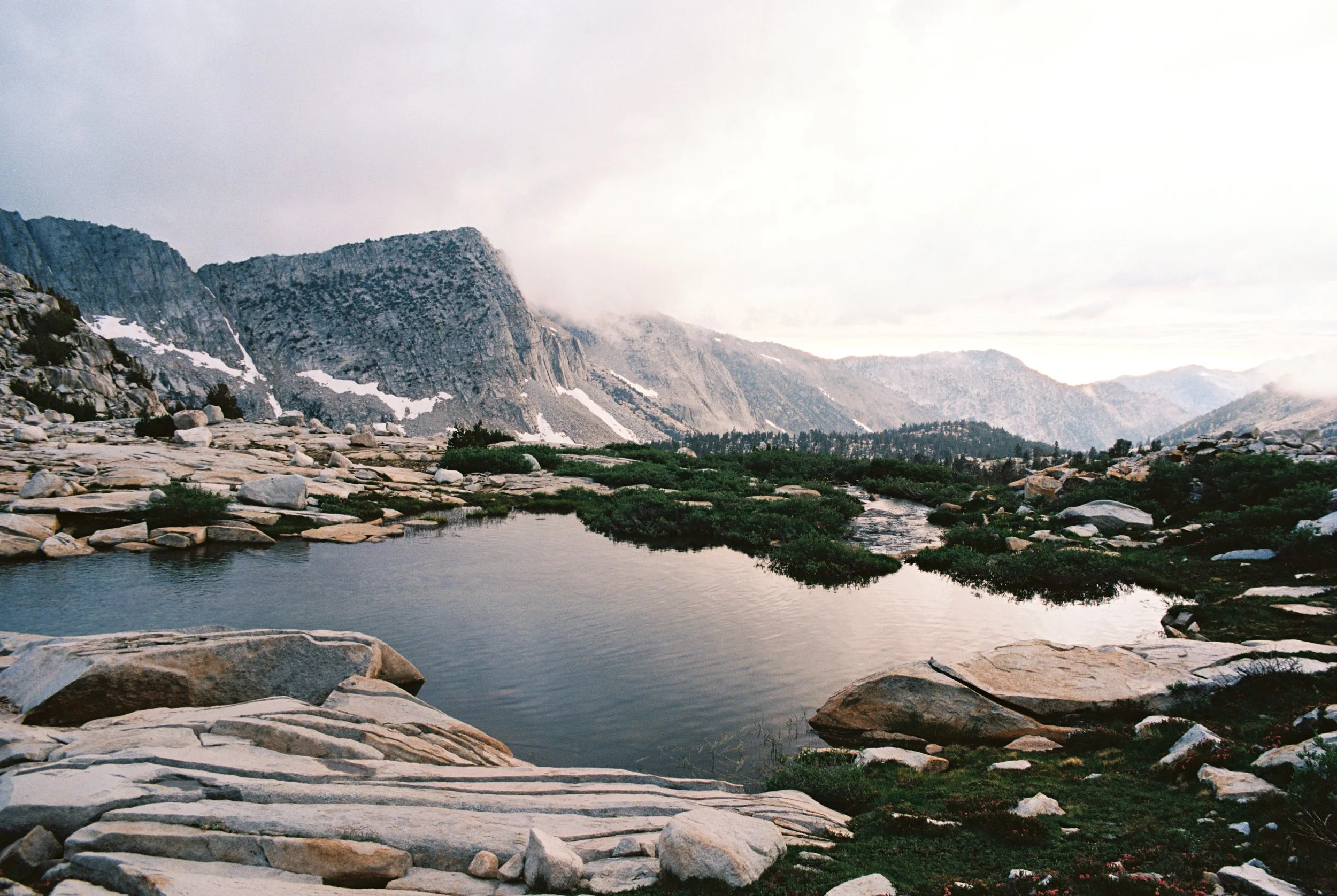
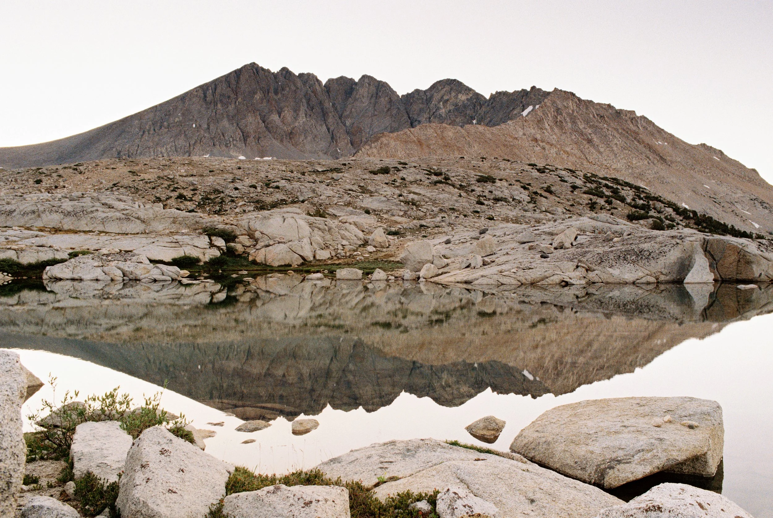
After the whiskey had finally settled the nerves, we set up camp and took a relaxing dip in the lake to take it all in. After the trials it took to reach it, Amphitheater Lake’s beauty felt even more profound.
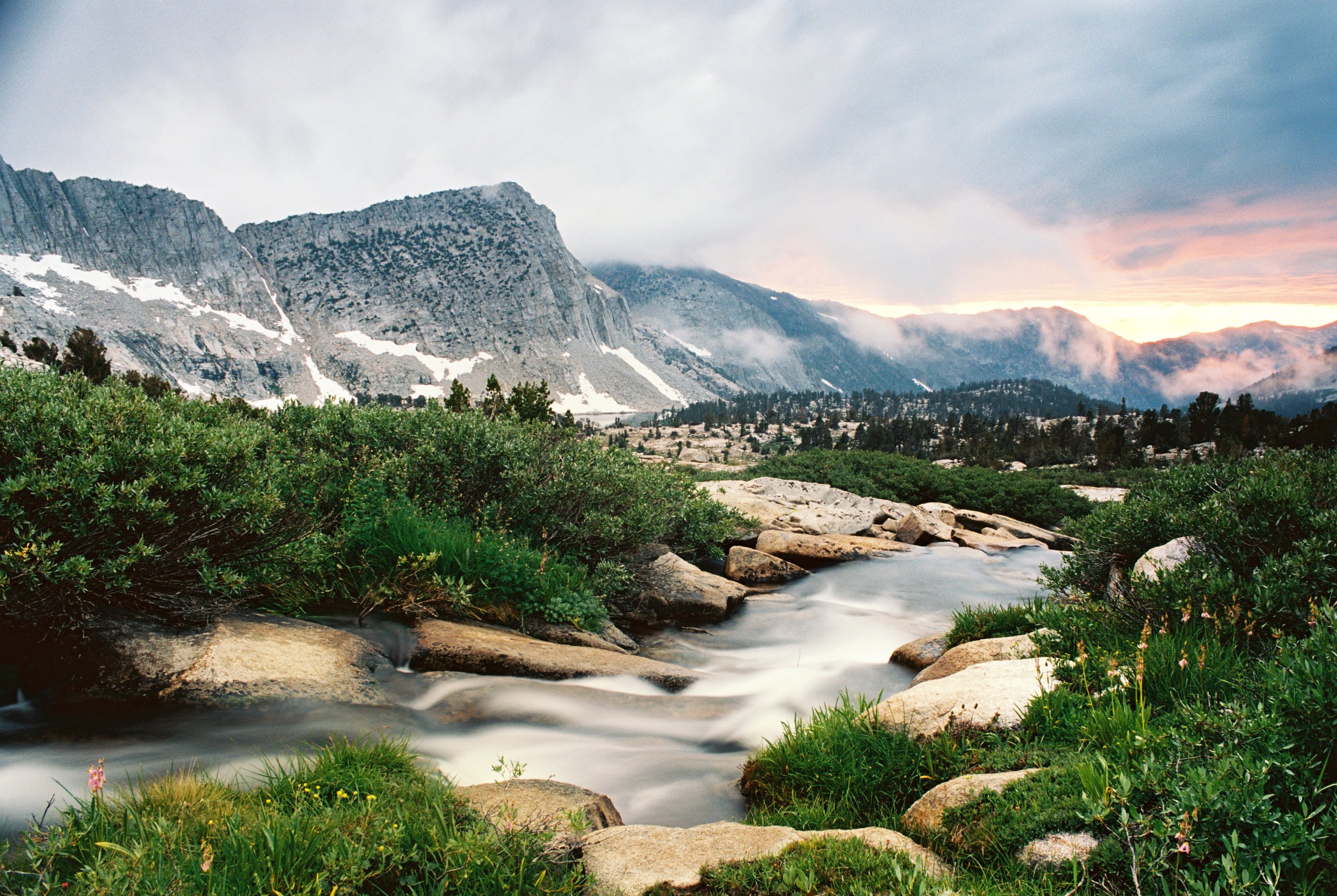
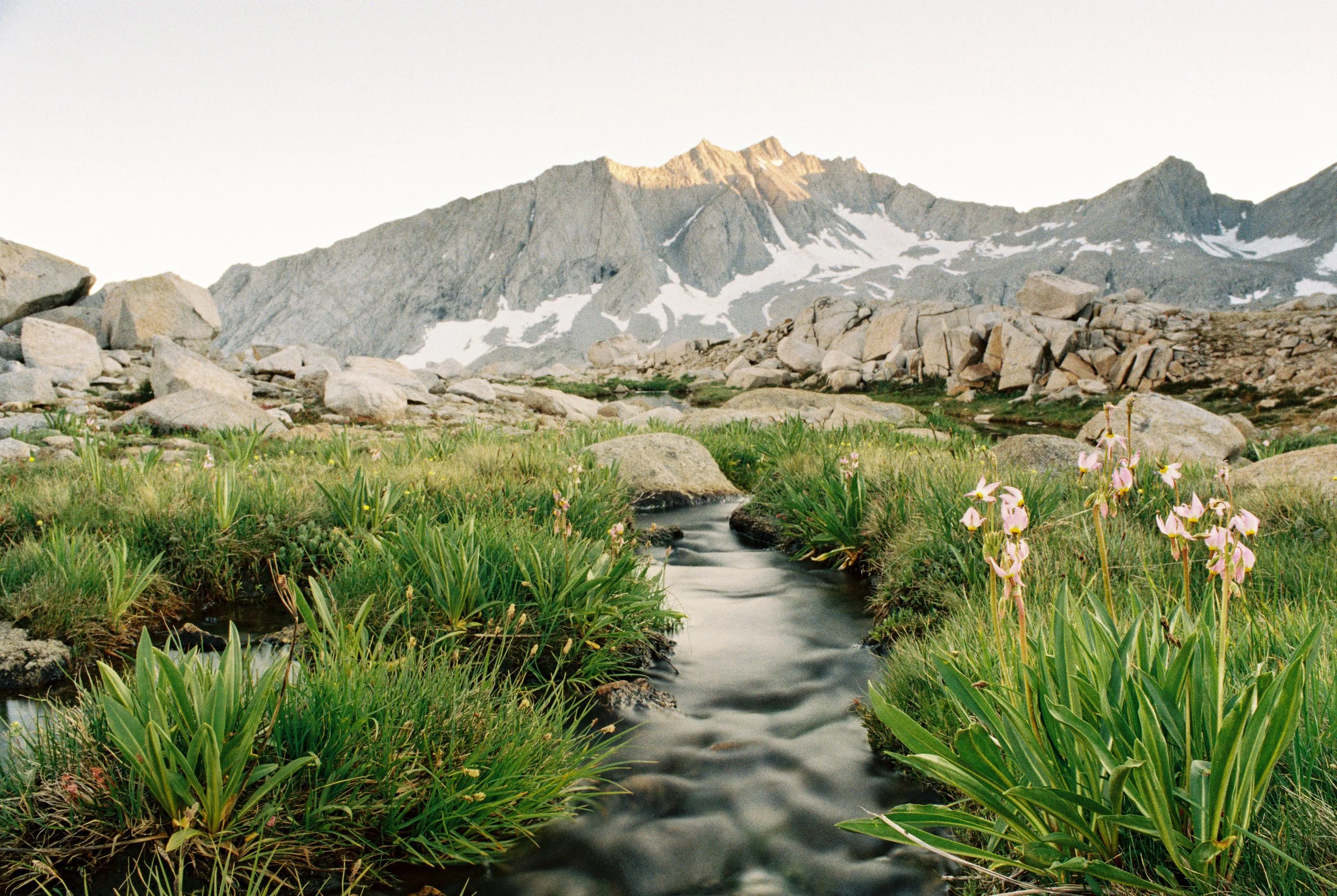
Before sunset, we wandered down to the lake’s outlet, where some of the finest meadows I’ve seen in the Sierra lined the creek. I found a quiet moment of zen sitting cross-legged on a boulder midstream, the water rushing around me on all sides.
Although I wouldn’t willingly use Cataract Creek Pass again, I’m grateful we navigated it safely and were able to experience Amphitheater Lake in all its splendor and solitude. Again, we were the only campers in this remote area that night.
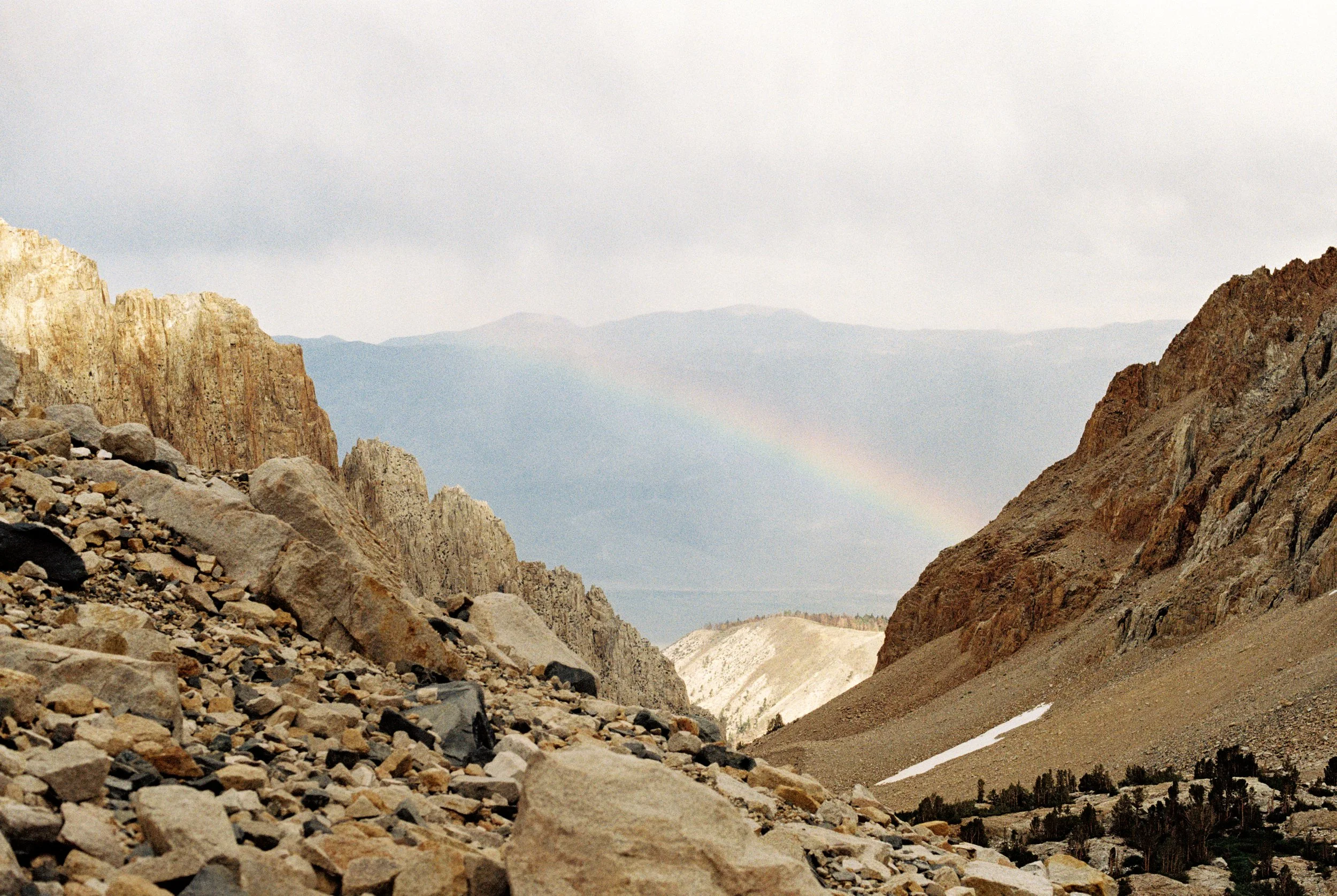
The following morning, we began the descent back to the JMT, which involved plenty of routefinding and bushwhacking along the Cataract Creek drainage. A faint trail appears in segments as you get closer to the JMT, but it’s unreliable, so it’s best to simply follow the path of least resistance.
We crossed Palisade Creek and hiked through Deer Meadow, filled with lovely tiger lilies and monkshood, before reaching the Sierra highway. There we met some thru-hikers who said they could see our bright clothing for miles as we bushwhacked down toward the JMT.
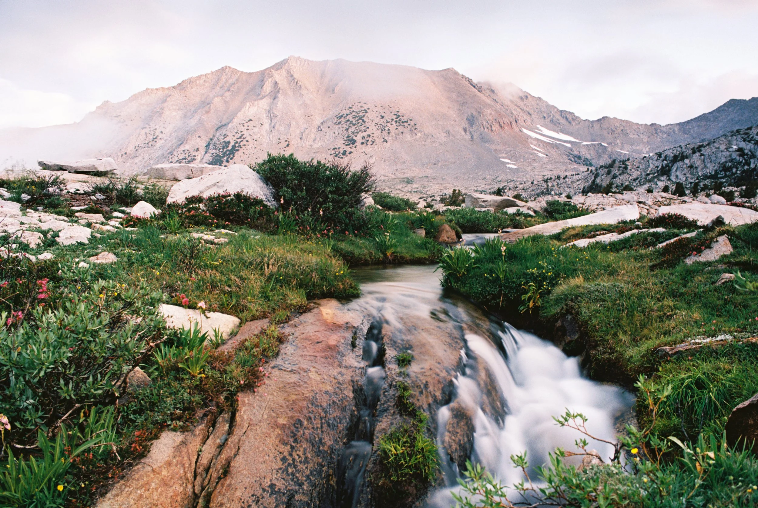
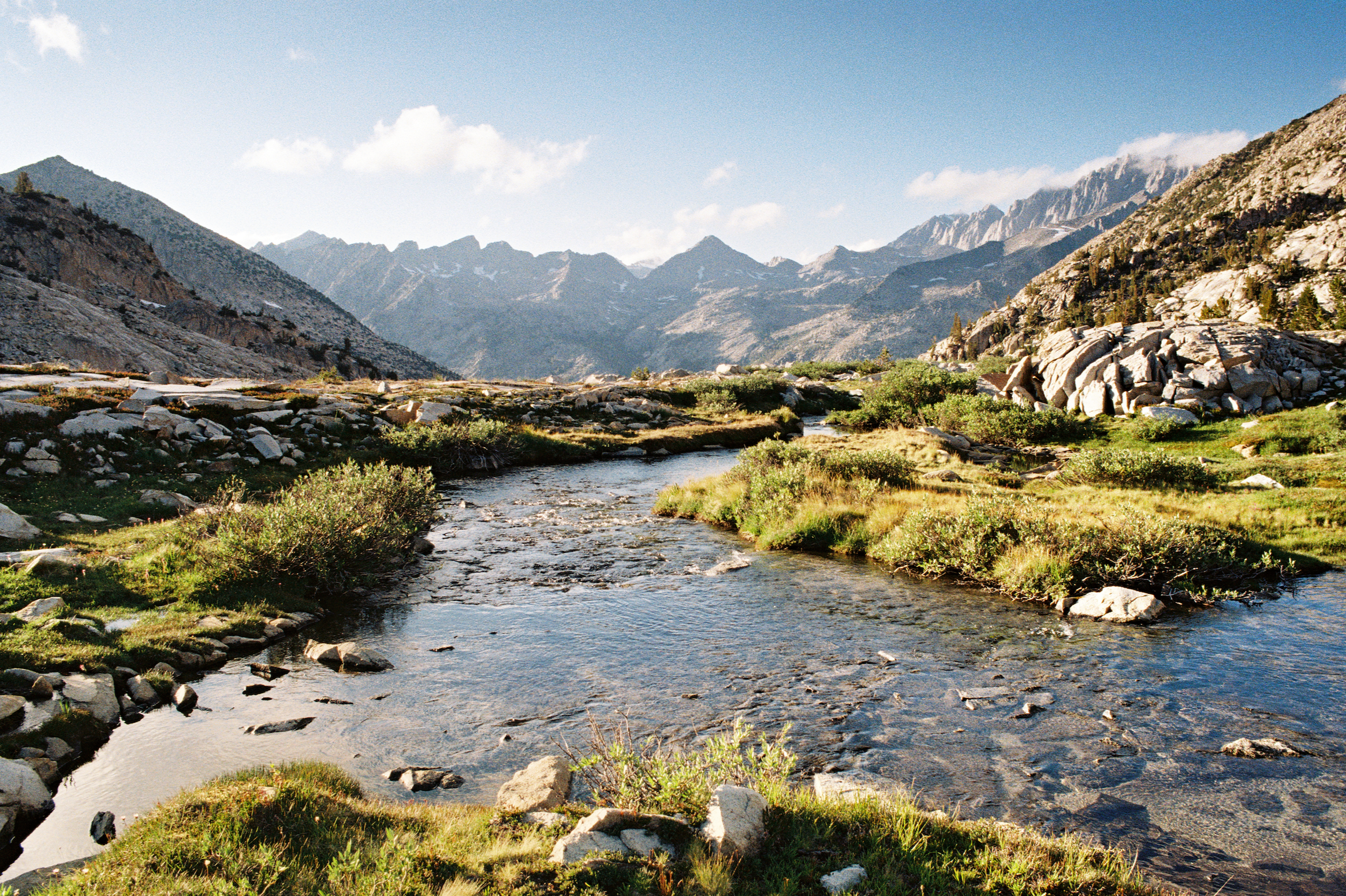
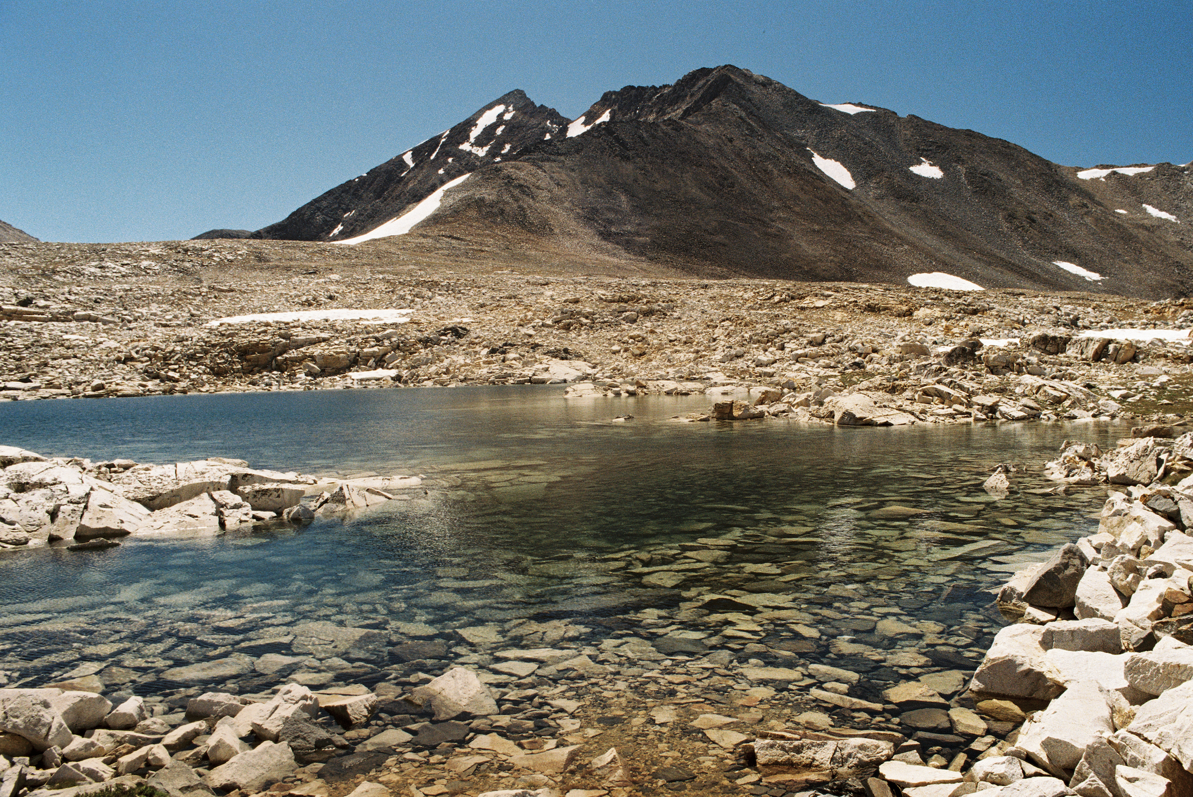
The next stretch toward Mather Pass climbs steadily but rewards the effort with impressive views of the Palisade range and a few roaring waterfalls. Having dropped to below 9,000 feet earlier in the day, we now had roughly 2,500 feet to regain before reaching the pass.
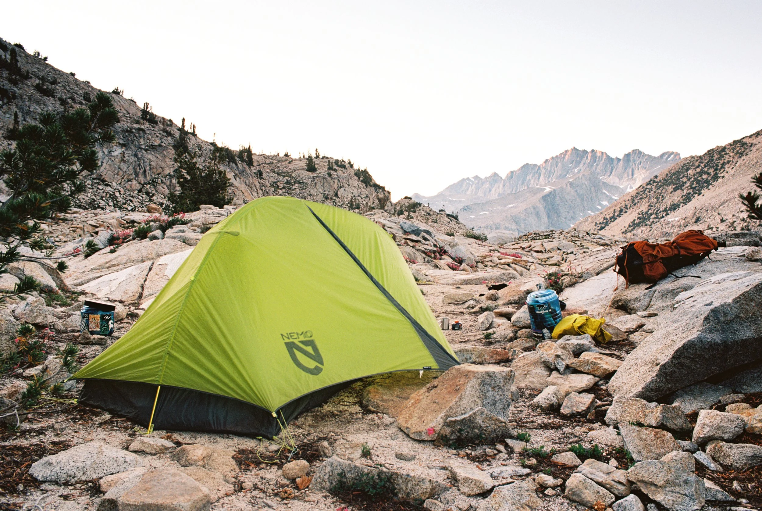
The rocky approach winds upward along well-built switchbacks, where the occasional pika can be spotted among the talus. For our final night, we camped beside a series of small ponds just below the pass.
The hike out the next morning was easy going, with much better weather than when we hiked in. We took our time enjoying the meadows surrounding Taboose Pass, knowing there was just one sketchy creek crossing left between us and the car.
To date, this route is the most demanding we’ve completed in the Sierra. If you’re considering it, be sure to take the proper precautions for off-trail travel, including carrying a satellite communicator, identifying backup exit routes in case a pass cannot be safely attempted, and using good judgment.
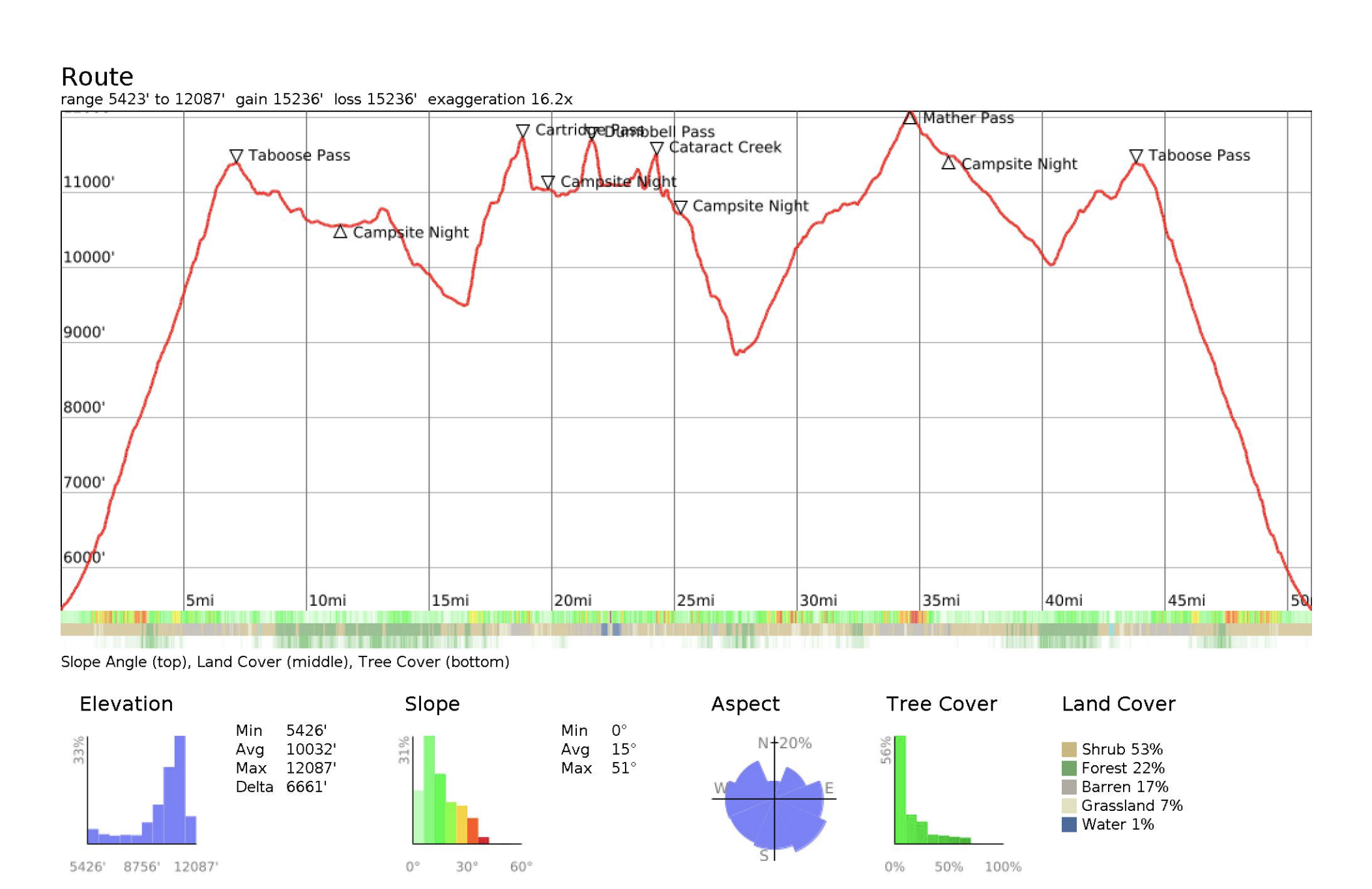
Elevation profile of the route.