East Lake, Lake Reflection, and South Guard
Trip Breakdown
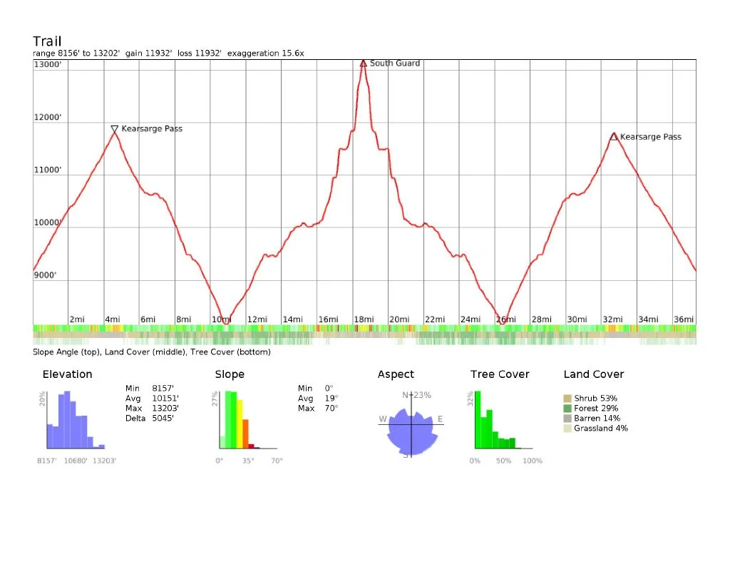
Difficulty Rating: Medium Days/Nights: 4/3 Distance: 37.34 mi
Elevation Range: 8,157' to 13,202' Total Elevation Gain/Loss: +11,932'-11,932'
Time of Year: Memorial Day weekend 2026 Snowpack: 33% (Southern Sierra April 1 average)
The Good: Snow-free main trails; no bugs
The Bad: High creek crossings; early season thunderstorms
Marmot sightings: 6
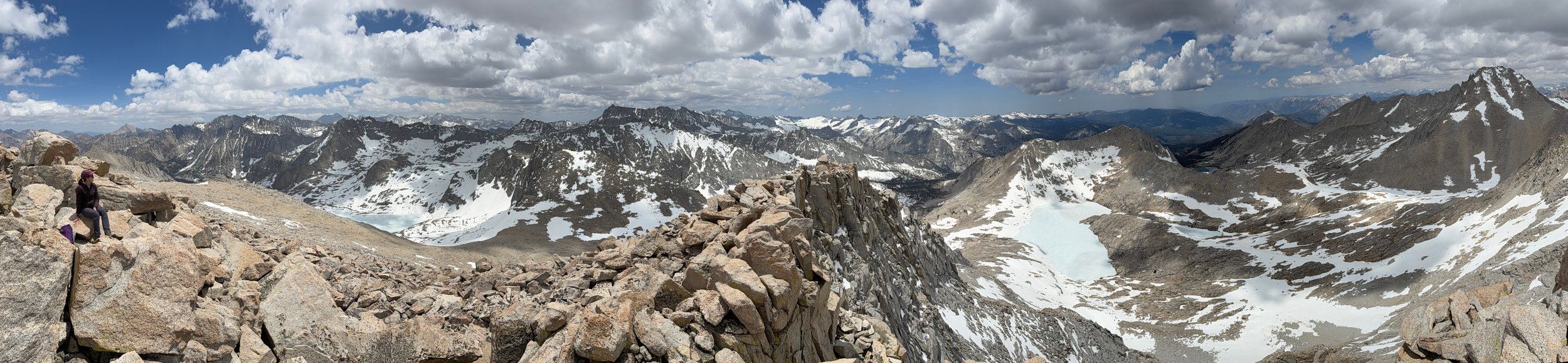
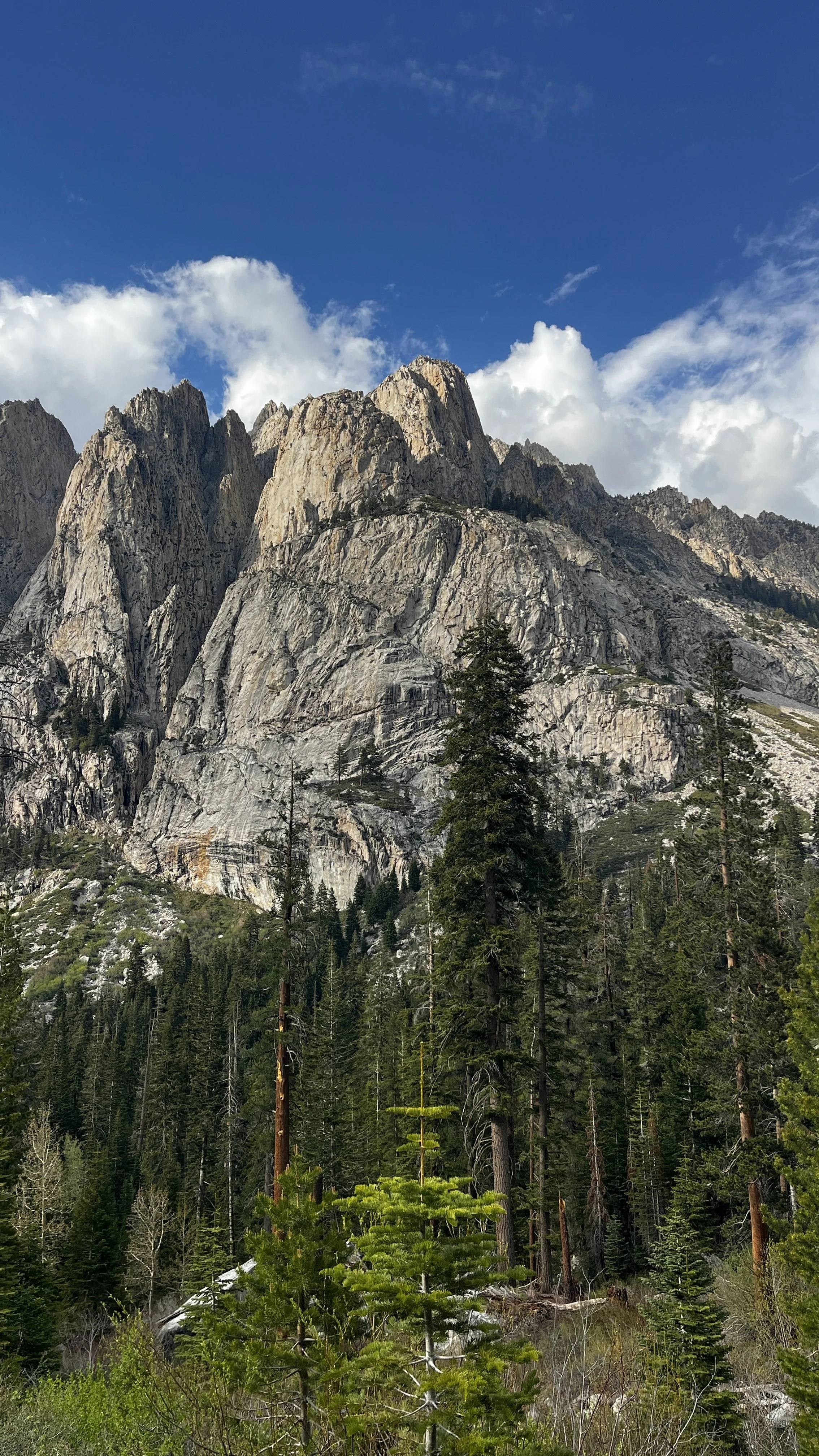
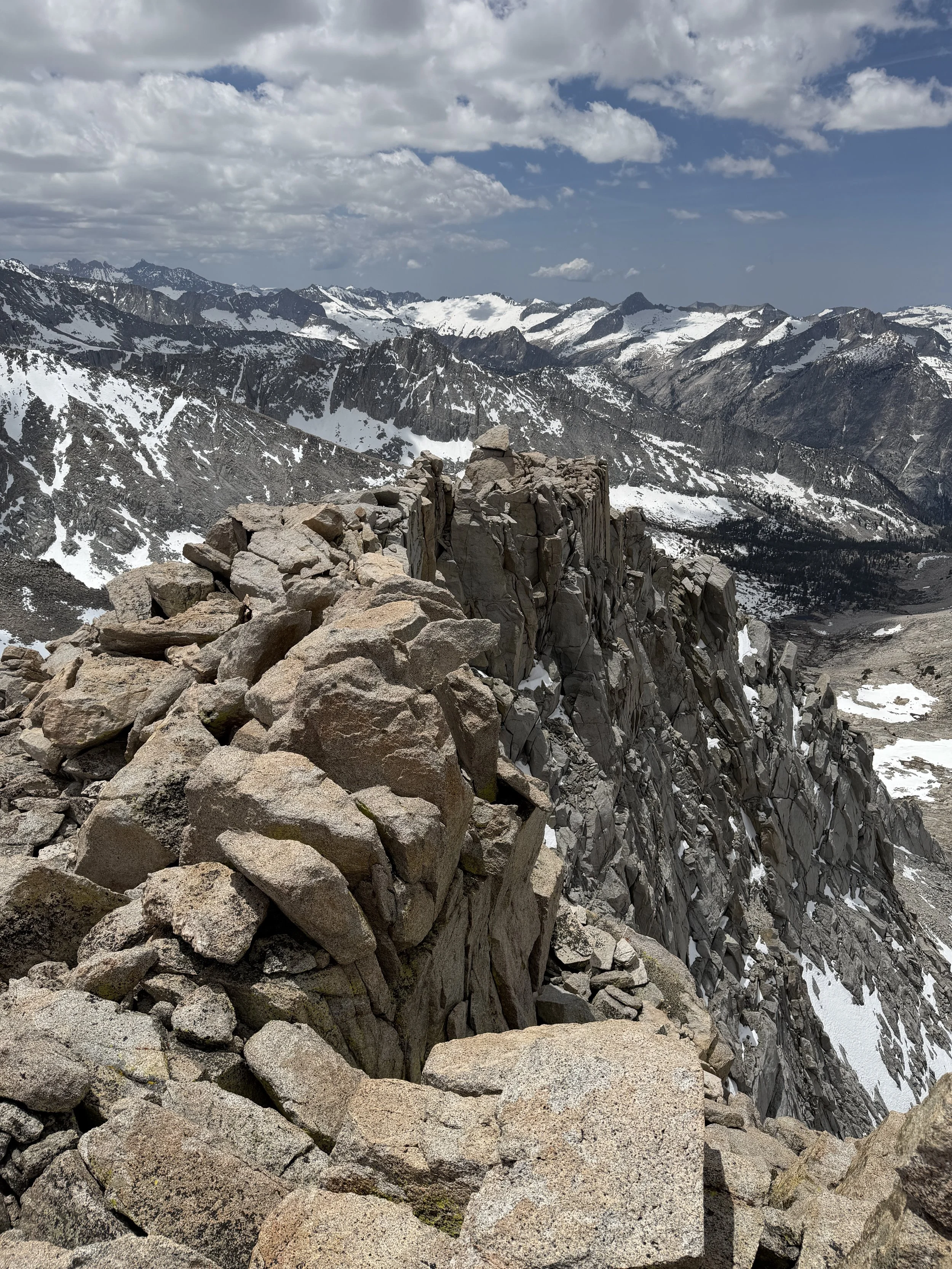
View from South Guard summit.
A Brief Trail Preview
Kearsarge Pass is a coveted permit for good reason. The access-to-difficulty ratio is hard to beat in the Eastern Sierra. Inyo National Forest offers a whopping 60 permits a day for this trail and it is often still difficult to snag a permit most weekends.
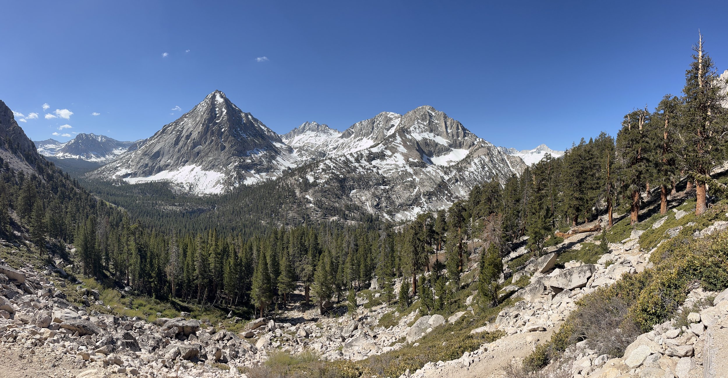
The climb from Onion Valley to the pass (11,760 ft) is a scenic and gradual ascent, passing many lakes along the way. The trail offers easy routes to popular destinations like Rae Lakes and Sixty Lakes Basin.
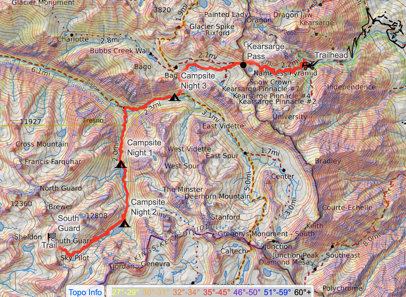
For this trip, we headed south, dropping down the Pacific Crest Trail to Bubbs Creek Trail, continuing west. We crossed Bubbs Creek at Junction Meadow and made our way up East Lake Trail. We used this trail to get to East Lake, Lake Reflection, and beyond to South Guard peak.
Trail Diary
Our first trip of the 2026 season came early due to the unusually warm spring we had across California. We kept an eye on the snowmelt throughout May on Copernicus until we deemed Memorial Day permits were doable and secured our permit less than two weeks in advance of the trip. We opted for a more southern trailhead as the snow tends to melt off faster in the southern Sierra.
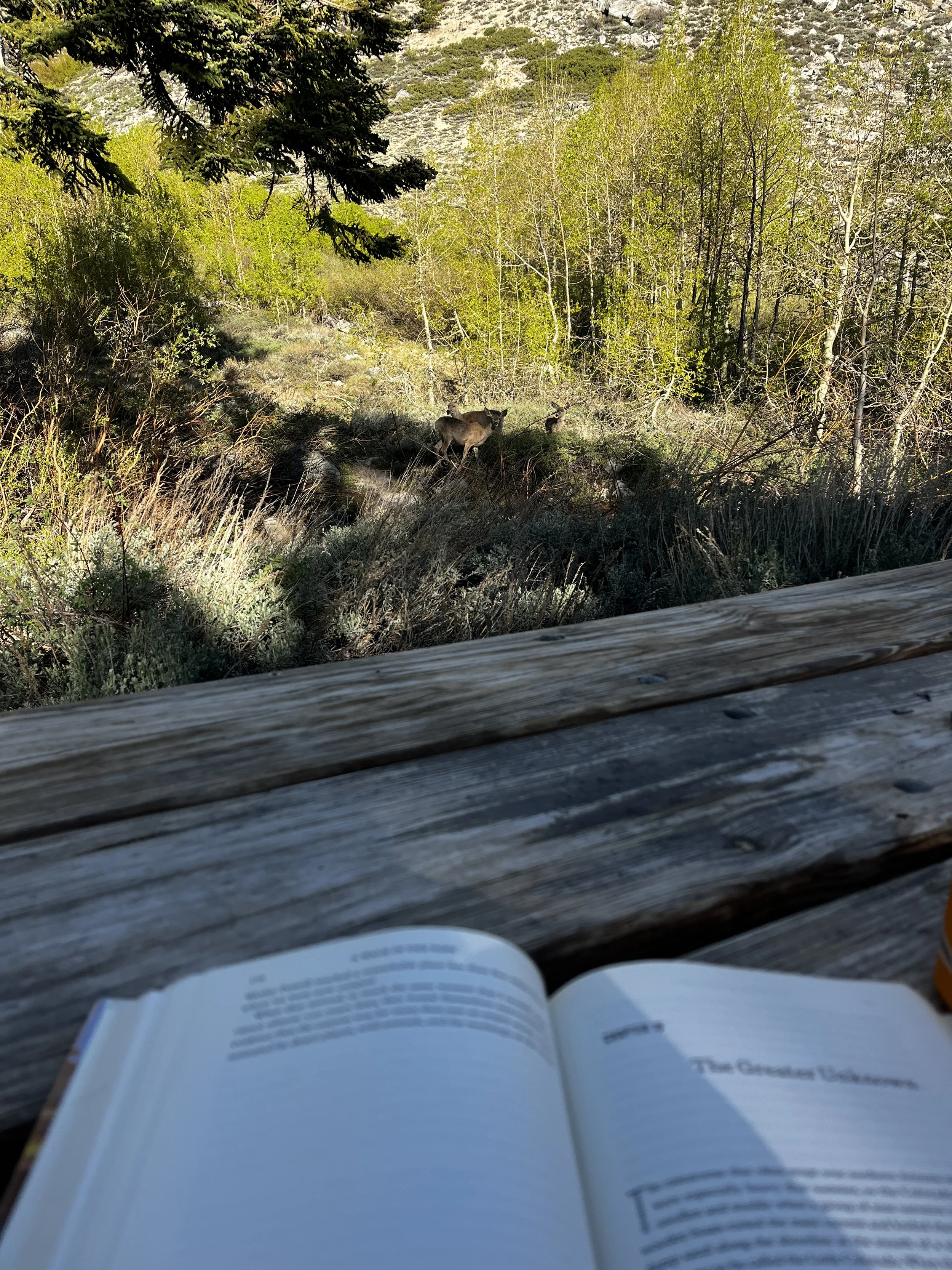
We loaded up the Jeep and hit the road after work on a Thursday and thankfully missed most of the evening traffic. Coming from sea level we like to camp at the trailhead the night before to get just a little acclimated to the elevation prior to hiking. We camped at the Onion Valley campground next to the Kearsarge Pass Trailhead, which sits at 9,200 ft. Only 9,100 feet more than where we came from. Anything helps!
Unfortunately our late night campsite selection was poor. We pitched our tent next to a group pounding Budweisers until 3:30am. After a few aggravating hours, I opted to sleep on the backseat of the Jeep for more noise insulation but only managed 3.5 hours of sleep. Waking up very groggy, I set to making coffee and organized my pack while giving our lovely neighbors the stink eye as they emerged from their respective tents.
We started up the trail around 9:30 a.m. as the parking lot began filling with day hikers and trail runners. From checking the Sierra Nevada Condition Reports and the Current Conditions Facebook group before the trip, we knew there would be two small snow sections up to the pass, but the snow we encountered was inconsequential. The warm spring had already done a number on the early season snow.
The 4.7 miles to Kearsarge Pass took us a little over two hours and we were greeted by a recently emerged marmot at the pass. From the pass we could see that the Kearsarge Lakes were still partially frozen but all the ice and snow added to the drama of the scene. The pass itself was packed with PCT hikers on their way to resupply in the Owens Valley. We chatted with a group from Germany, Latvia, and the UK about the conditions of the nearby high passes.
The rest of the afternoon was scenic but uneventful hiking along a brief portion of the PCT and then onto Bubbs Creek Trail heading west. Along the way we stopped at a few waterfalls and encountered a ranger on an preseason training trip. She checked our permit and asked us a few questions about our backcountry plans. Before parting, she forewarned us that Bubbs Creek might be running high in the early season and could prevent us from getting to our destination, Lake Reflection.
With the rangers warning in mind, we talked through alternatives if we couldn’t make the creek crossing. We grabbed long sticks off the side of the trail to possibly aid us in our attempt. When we got to Junction Meadow, we couldn’t find a route that wouldn’t either sweep us off our feet or get our gear completely soaked trying. We paced the bank for 30 minutes looking for somewhere plausible to cross. Tanner found a relatively shallow section west of the trail. It was about three times in length to cross compared to other areas but it was our best option.
Tossing some rocks in, I determined the crossing at its deepest would be about waist high for me and therefore I shouldn’t carry my pack. Thankfully Tanner is 7” taller than me so he could shuttle my pack across with much more clearance. To stay as dry as possible, we stripped down to our knickers but had to keep our boots on as the rocks in the creek were slick and sharp. We were a laughable sight to see. Thankfully not a soul was around.
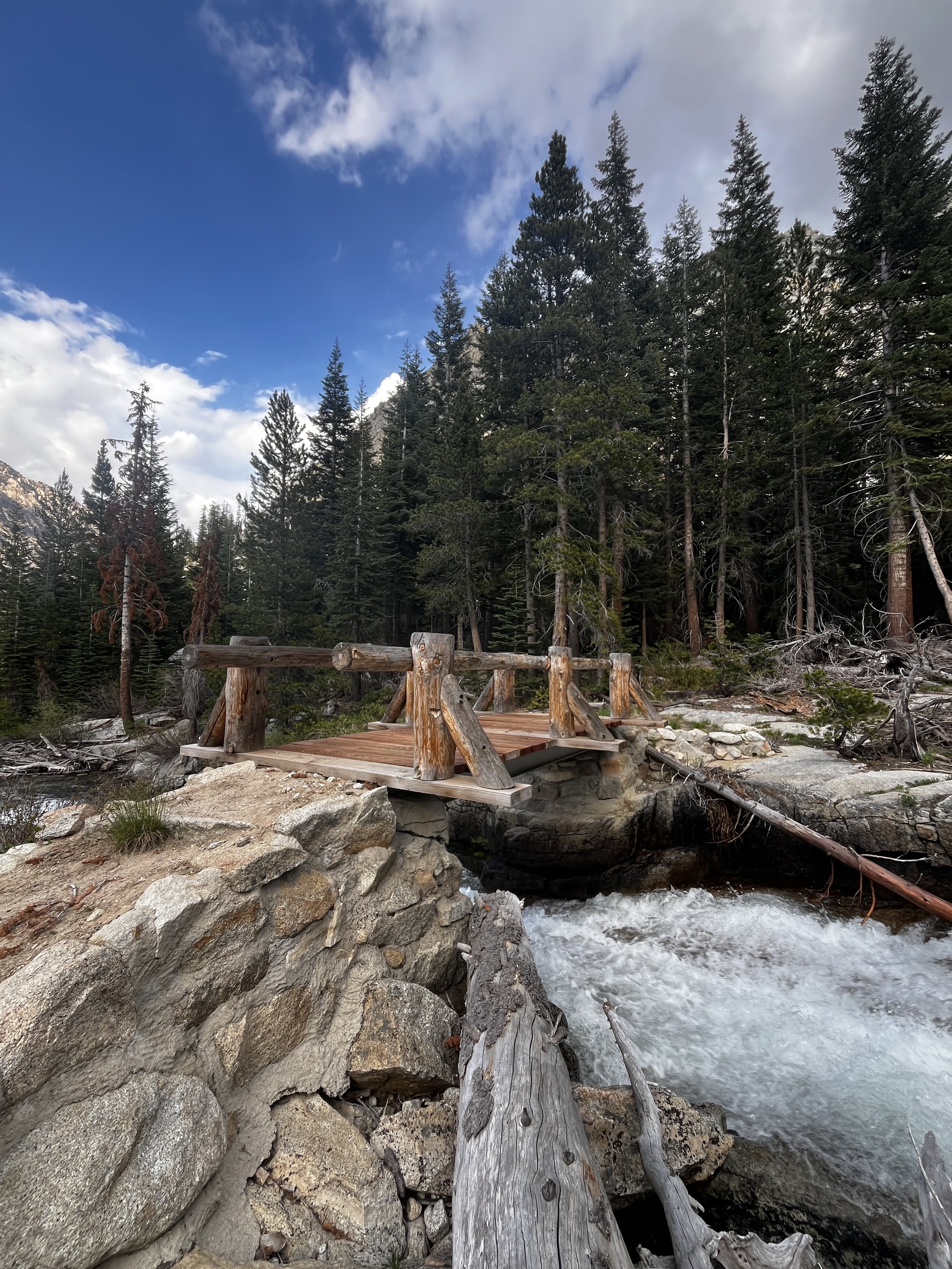
After my crossing (and Tanner’s third), we put our hiking pants back on and wrung out our socks and began climbing up East Lake Trail . The entire East Creek drainage appeared heavily impacted by avalanches and possibly a small fire. There were whole tree choking the creek and some serious chainsaw work done to clear the trail. There was also a newly constructed bridge across one steep section of the creek. We joked that the trail could use another bridge at Junction Meadow too.
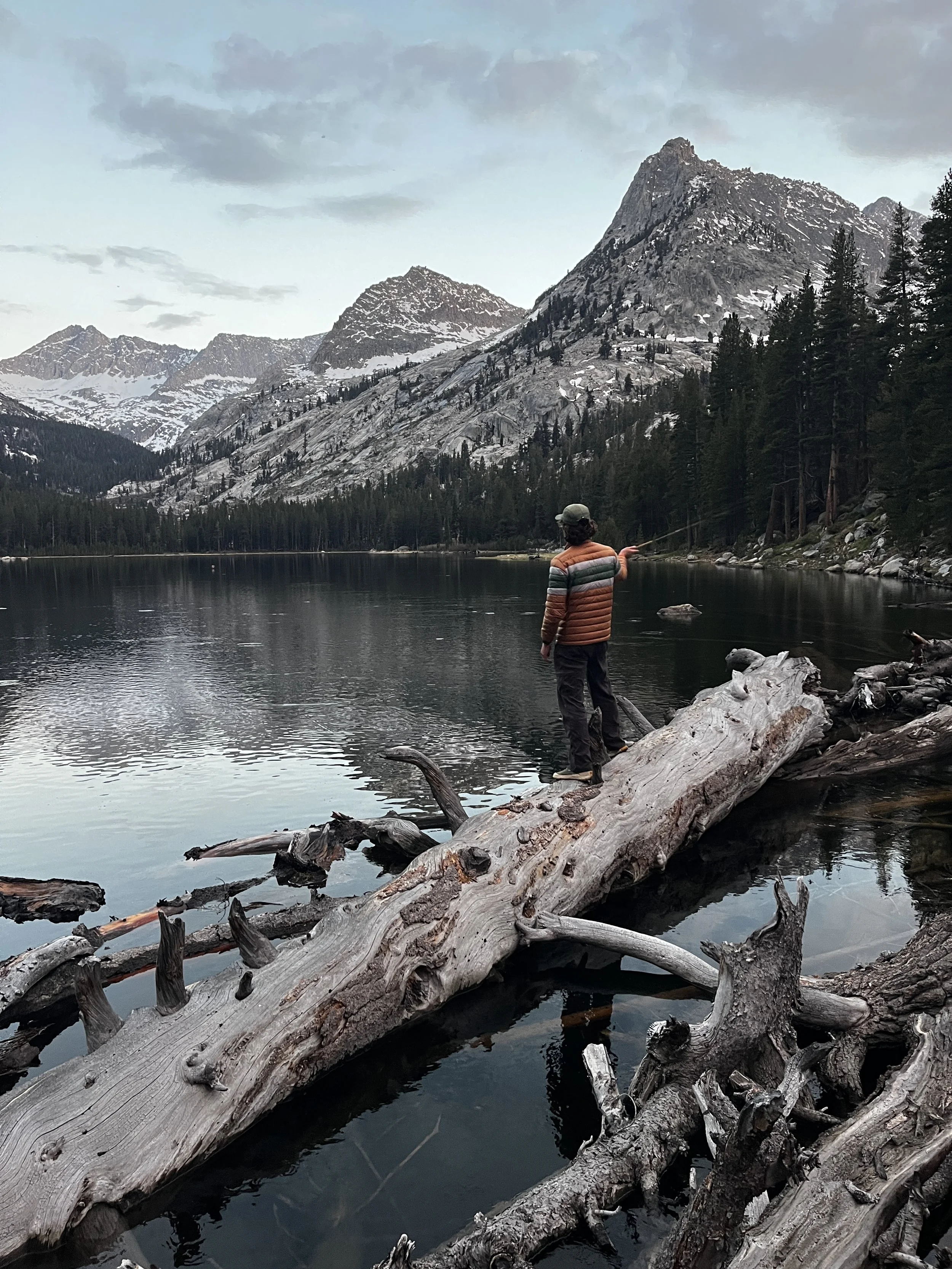
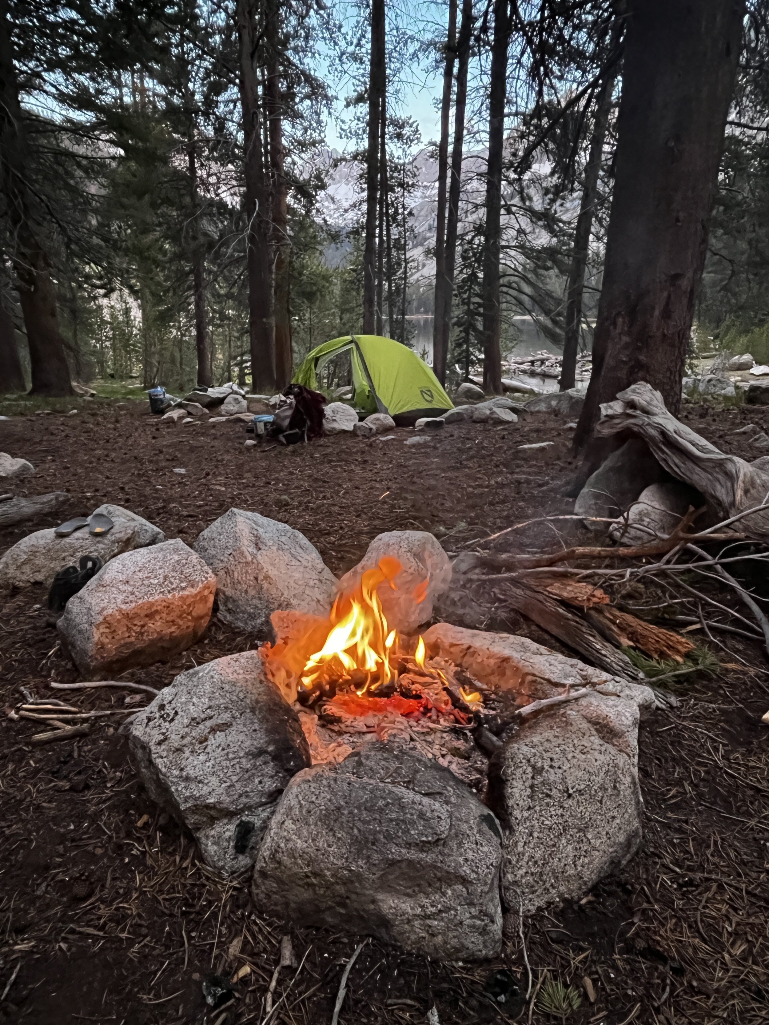
We arrived at East Lake around 7pm after 14.3 miles of hiking. Thankfully there was a great campsite there at the north end of the lake with the extra bonus of a fire ring, which we could use being that we we’re under 10,ooo ft fire restriction. A crackling campfire sounded delightful to warm up our soggy footwear and cold feet before bed. At sunset, Tanner had much success at East Lake with a Tenkara rod and some Brown trout at the lake’s outlet.
After a deep 8+ hour sleep (unheard of for me in a tent), we both woke up feeling quite beat. The combo of poor sleep at the campground the night before and the long miles the first day had us feeling quite lethargic. Our original plan was to move camp just two miles up to Lake Reflection and then go bag Mount Brewer. In our drained state, we decided to just move camp and delay the peak bagging a day to rest and get more time at high elevation under our belts before going over 13,000 ft+.
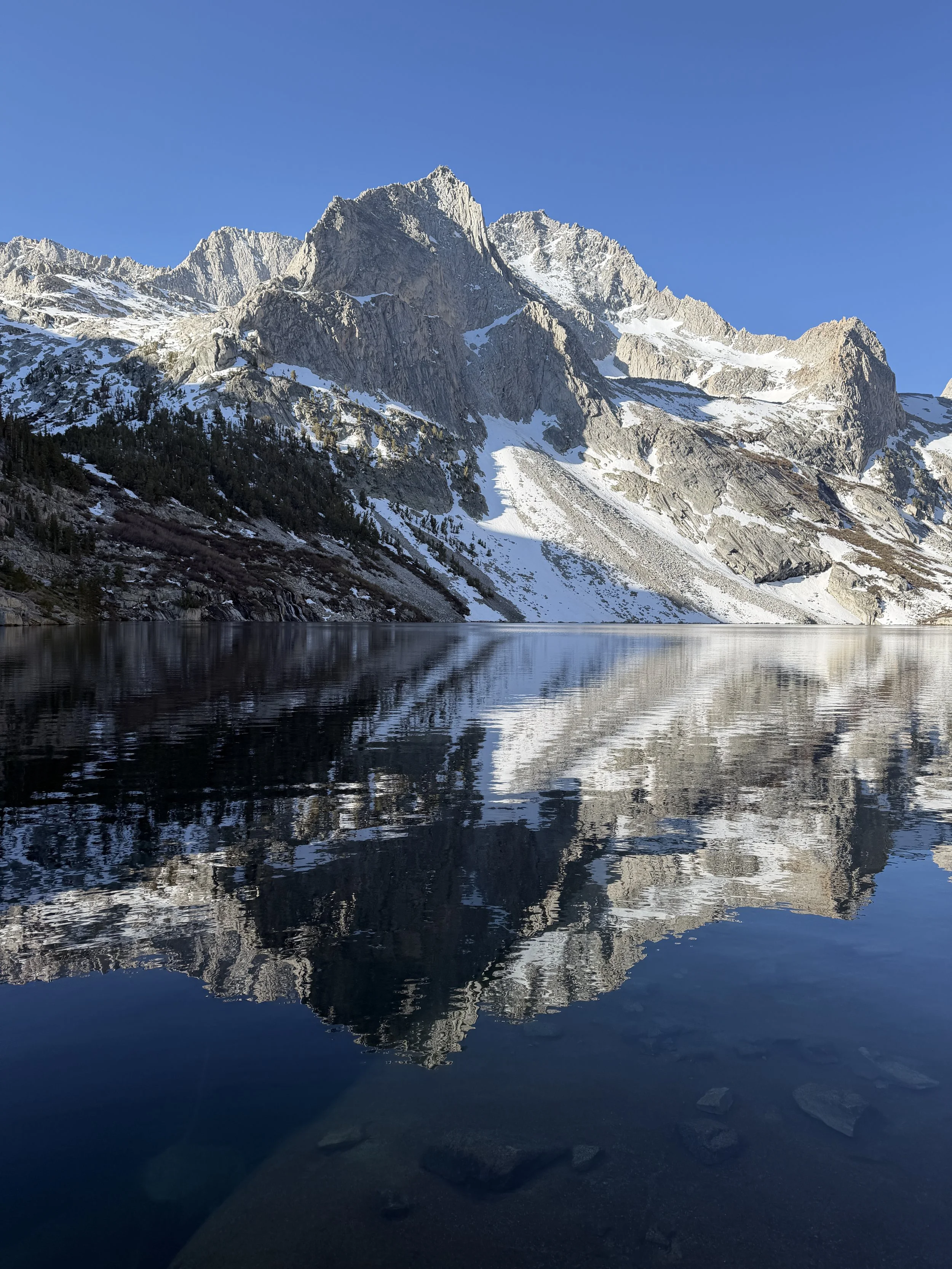
We packed up camp and hiked up to Lake Reflection. There was a group of two at the most obvious camping spot so we opted to set up camp along the east side of the lake. We pitched the tent, ate lunch and went for a swim before the clouds moved in. We spent the afternoon exploring a meadow below Lucy and Milly's Foot passes and deciding which peak to climb the next day.
I had my heart set on Mount Brewer after reading Secor, which boasts that it has “a wide, unobstructed view in all directions from its summit”. Unfortunately the more I researched the route, I found reports that the route up Ouzel Creek to Brewer was recently ravaged by avalanches. Looking at our maps, Tanner suggested we could approach from a different angle. The Garmin Explore map showed a route along the west side of Lake Reflection, over South Guard, and up Brewer. It was a little bit longer but seemed like it would require less log hopping and bushwhacking. We resolved to make that approach and agreed if we got up South Guard and were too tired or the weather turned, we would skip Brewer.
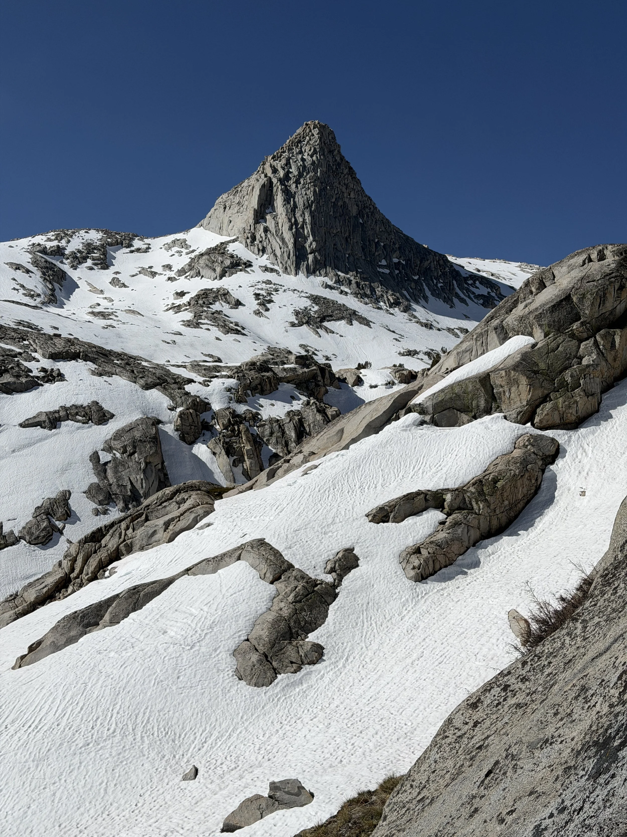
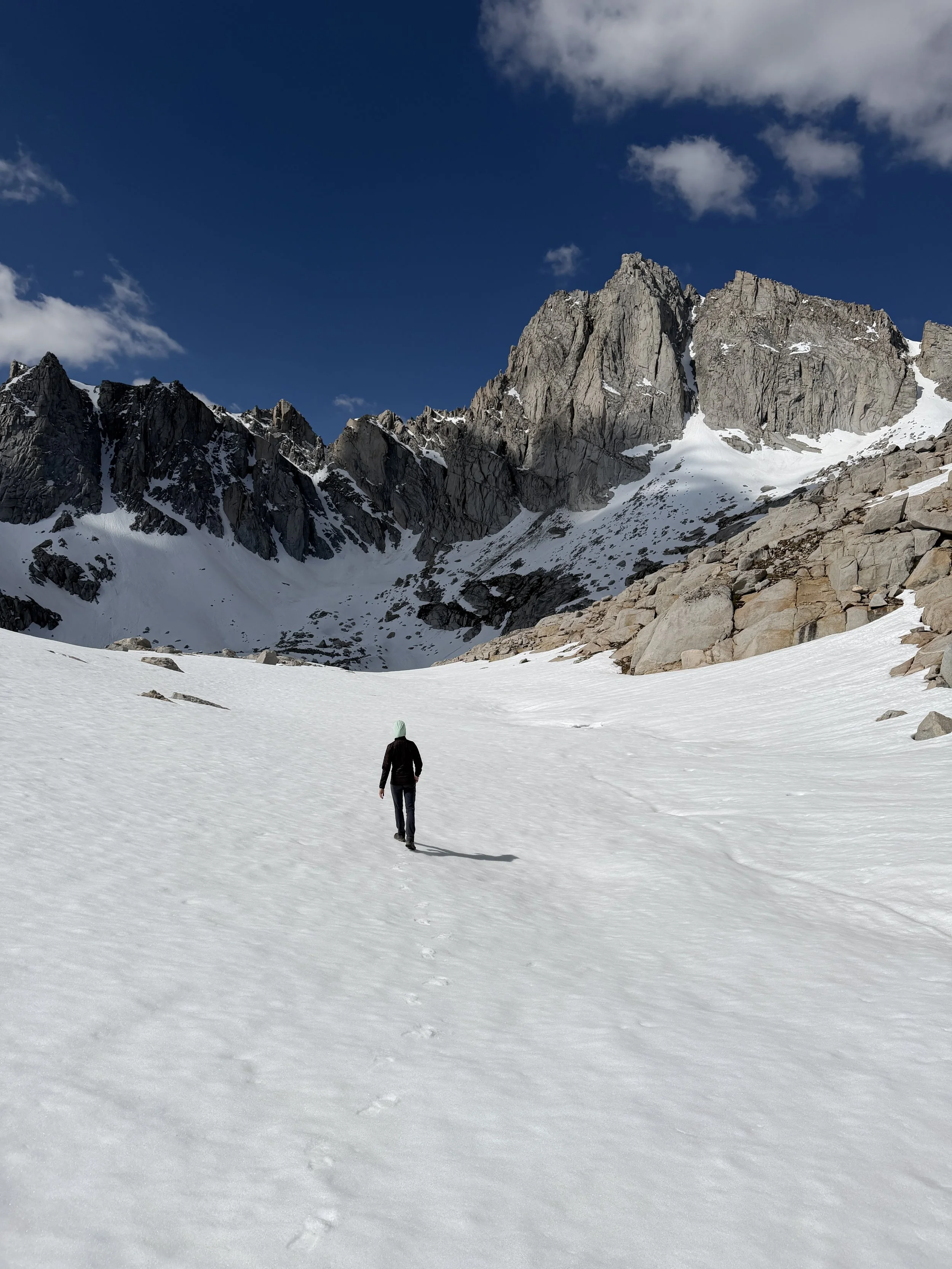
The next morning we work up early, made breakfast, and left our camp with just our daypack. We crossed to the northwest side of Lake Reflection and loosely followed the Garmin Explore route. Just pass the lake, we finally encountered some real snow for the first time on the trip. We put our microspikes on at the frozen lake below the heavily corniced Longley Pass and began snaking our way up. We were aiming for a snow-free chute just to the north of the pass.
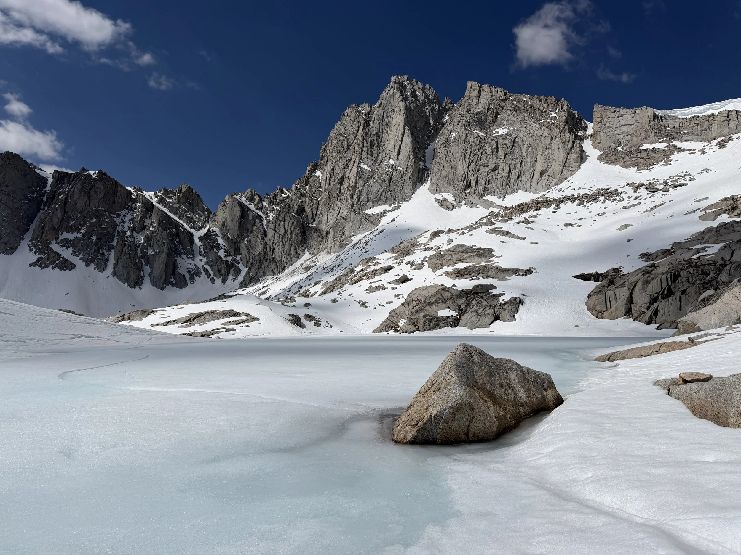
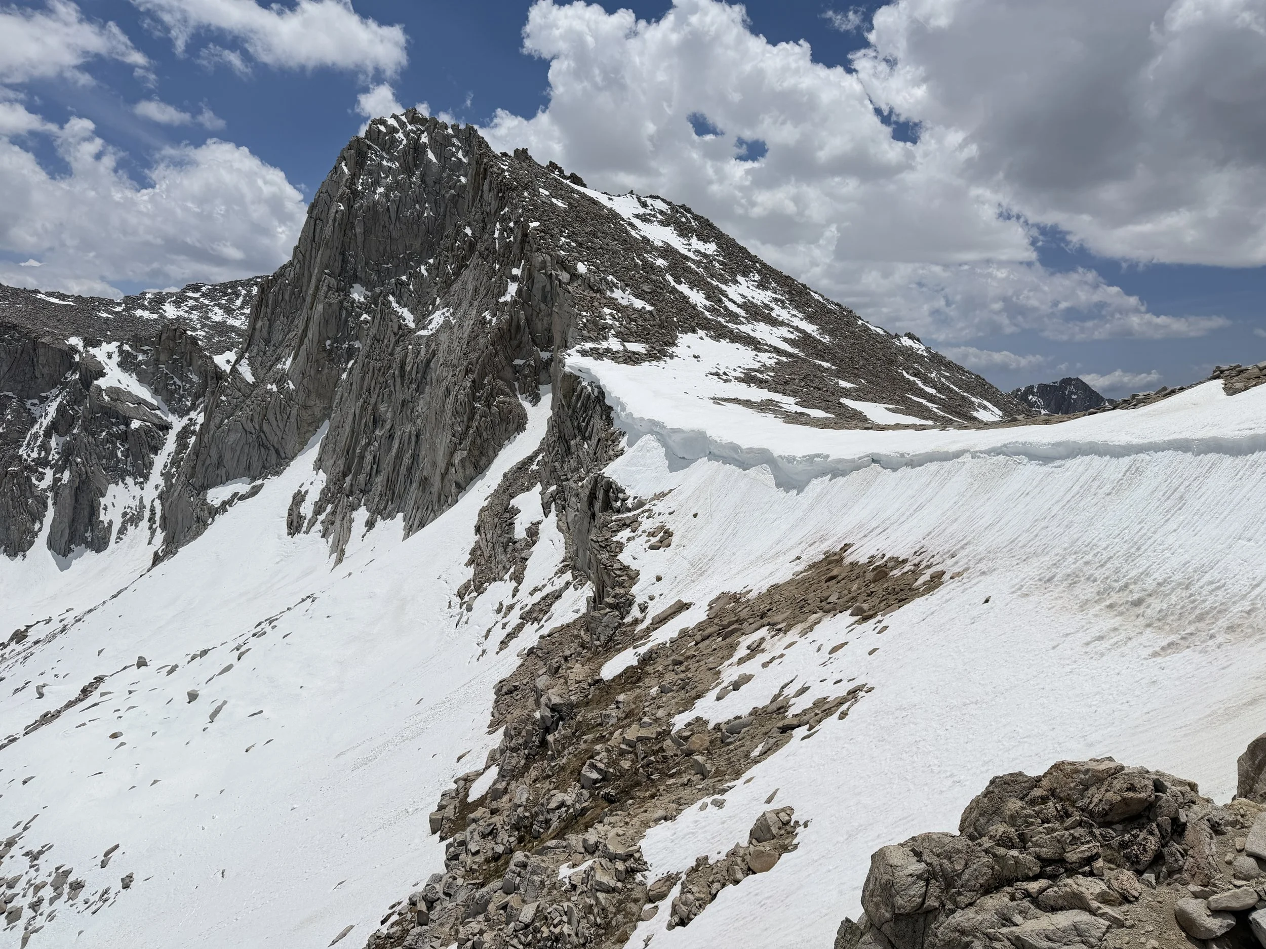
The chute looked intimidating from lake level but as we climbed, it began to appear more manageable. The chute required the use of my hands to climb up but there was little to no exposure (easy class 3). Once we emerged from the chute, it was a slog up a sloped boulder/scree field to the summit of South Guard. The elevation started getting to me around 12,500 ft and I had to take frequent stops to catch my breath but no High-Altitude Headache (HAH) thankfully.
We finally reach the top around 11:30 am. We signed the summit register and ate our bars while taking in the views. The range was socked in with snow to the south of us (Whitney zone) and snow-free to the north. Quite the juxtaposition. Around noon the clouds began to move in from all sides and we were satisfied enough with South Guard to not want to attempt Brewer. This ended up being the right call, as a thunderstorm moved in 30 minutes later. Happy to be off the summit, we started quickening our pace as we navigated back to Lake Reflection. It soon began to snow and we cliffed out quite a few times on our descent.
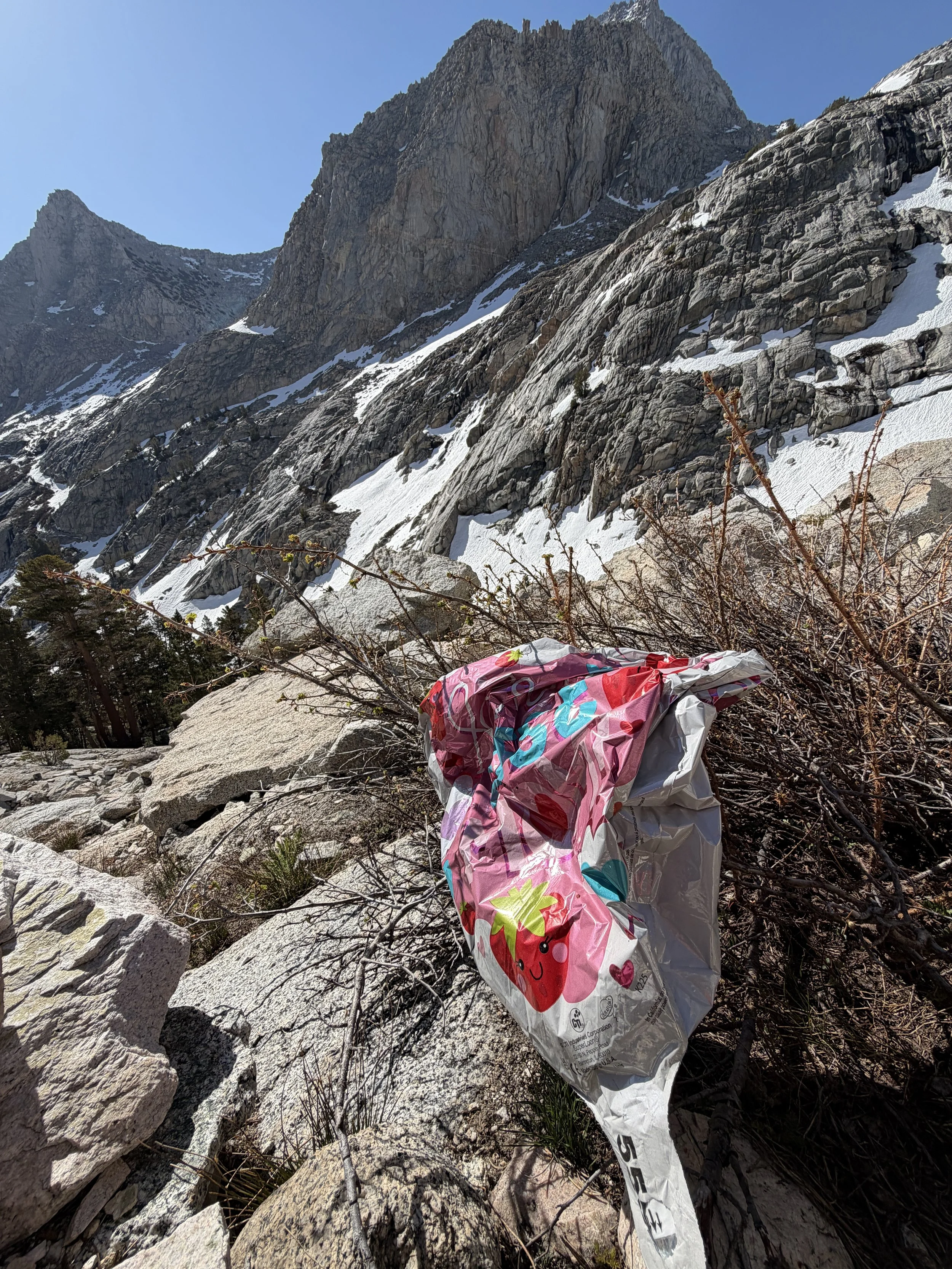
To note: If you've ever wondered where released balloons end up, they're often in high, remote places. We've found countless balloons in the backcountry—two on this trip alone.
We got back to our campsite around 4pm and ate lunch in our tent as it continued to precipitate. Sad to say, our mileage was not done for the day. We still needed to hike out and get as close to the junction of Bubbs Creek and the PCT in order to avoid a long exit day. We packed up our soaking wet tent and hiked back to Junction Meadow in the rain.
We crossed the same section of creek around 7pm, again pantless and began the climb back up the Bubbs Creek drainage. After pausing at a waterfall for sunset, it was time to turn the torches on and get our butts to Lower Vidette Meadow. We had a site in mind, as we had passed an equestrian campsite along the creek that had a fire ring and benches on our hike in.
We finally spotted the exact site around 9pm, a relief after a 13 mile day. We set up our wet tent, got a fire going, and laid out our socks and shoe as we made dinner and sipped tea under the stars.
The next morning we explored Lower Vidette Meadow in the daylight and made breakfast as we slowly broke down camp. I found a stagnant pond nearby and upon close inspection saw hundreds, if not thousands of mosquito larvae wiggling around. I laughed knowing that, in just a week's time, this camp would be absolutely overrun. Early season perks!
East Vidette from the PCT.
We started hiking and realized we ended up camping only 0.14 miles from the JMT junction. The switchbacks here always kick my butt but treat you to a view of East Vidette (one of my favorite peaks in the Sierra). Thankfully once you get to Bullfrog Lake it levels out for a bit. We stopped a few times to snack and take in the exquisite views of the Kearsarge Pinnacles. As always on exit day, we were a little reluctant to return to real life. The trail was busy below the pass with people enjoying fishing and hiking on Memorial Day. The clouds moved in the way they do most afternoons in the Sierra and we got back to the Jeep an hour shy of the thunderclouds settling in.
We cleaned up in the creek and made our way out of Onion Valley with burgers on our brains. We stopped at Totem Cafe in Lone Pine and downed some burgers and beers (root beer for me as I was driving). We stopped by Big Willi Mountaineering Company as we’ve passed it many times but the timing has never been right. We chatted with the awesome shop owner Blair, a true Sierra legend, who gave Tanner a roadie for buying a Big Willi hat. Love meeting the characters that call this beautiful and strange place home.
A solid rust-busting trip to kickoff the season. We spent half the drive home plotting our next trip. Cheers!