
Baxter Pass Lollipop Loop
Trip Breakdown
Difficulty Rating: Hard Days/Nights: 4/3 Distance: 31.31 mi
Elevation Range: 6,001' to 12,278' Total Elevation Gain/Loss: +11,191'/-11210'
Time of Year: Early July 2025 Snowpack: 84% (Southern Sierra - Below Average)
The Good: Shortest of the “Four Nastys”; easier permit to get than Kearsarge Pass
The Bad: Steepest of the “Four Nastys”; unmaintained
Marmot sightings: 0
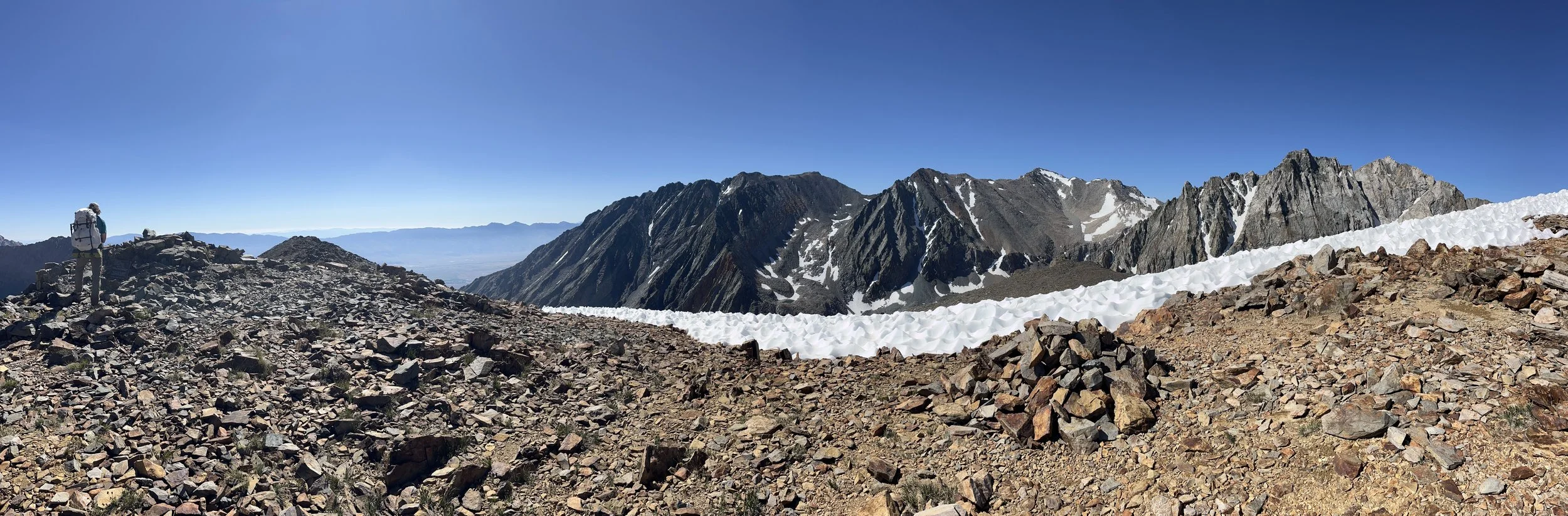
Top of Baxter Pass.
A Brief Trail Preview
On the east side of the Sierra Nevada there are some notorious passes lovingly referred to as the “Four Nasty Passes”, each climbing upwards of 5,500 feet from their trailhead to its pass. These include Baxter Pass, Sawmill Pass, Shepard Pass, and Taboose Pass. Baxter Pass is the steepest, climbing over 6,000 feet in roughly 5.6 miles.
Having previously endured Sawmill and Taboose, I came into my third “Nasty” expecting to be punished and who doesn’t love a good butt kicker? This trail was not my first choice as a season opener but that’s sometimes how the cookie (recreation.gov) crumbles.

Route map.
The Forest Service page describes the trail as follows: “Baxter Pass Trail is steep and rugged. In some places it is difficult to locate.” and they’re not wrong. This bad boy is largely unmaintained.
There are sections where you are walking through head-high thorny shrubs and cannot see your feet on the trail underneath you or your hiking partner ahead of you. There is a “Ghost Trail” that weaves through the actual trail and makes it appear that you cross the creek numerous times (you only cross the creek twice - more on that later).
Tip: The Garmin Explore app that pairs with the inReach really helps keep your bearings when they were in question.
Trail Dairy
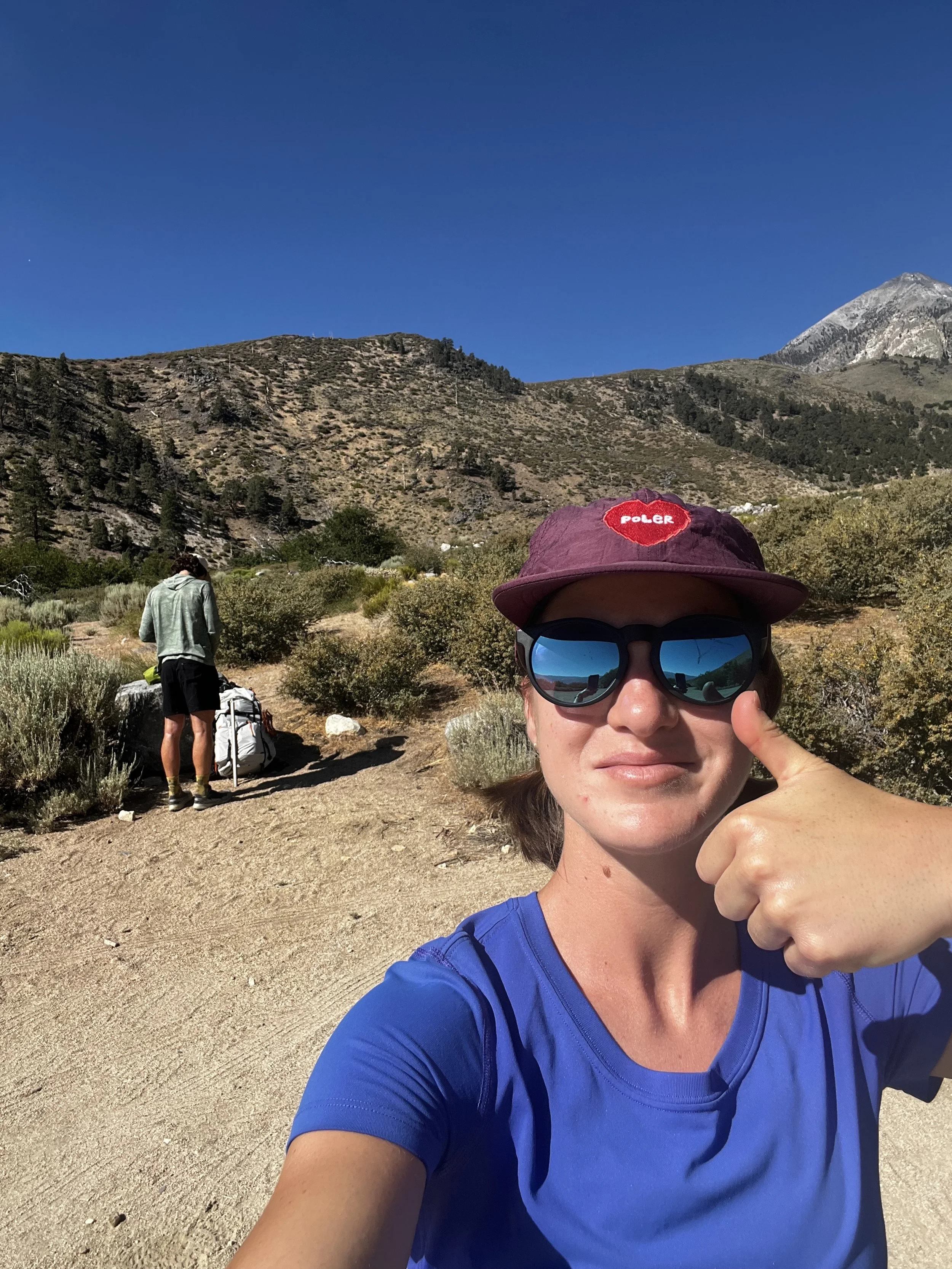
Living at sea level we usually make the trek to the east side the day before and camp at a campground nearby to acclimatize a little and get on the trail as early as possible. We camped at Oak Creek Campground nearby. With the Baxter Pass trailhead at only 6,037 feet, it is highly recommended to get an early start (9am was definitely not early enough).
To note: The trailhead has a food storage locker and the parking lot can probably accommodate roughly 10 standard cars but this is a non-issue because this is not a popular trail head.
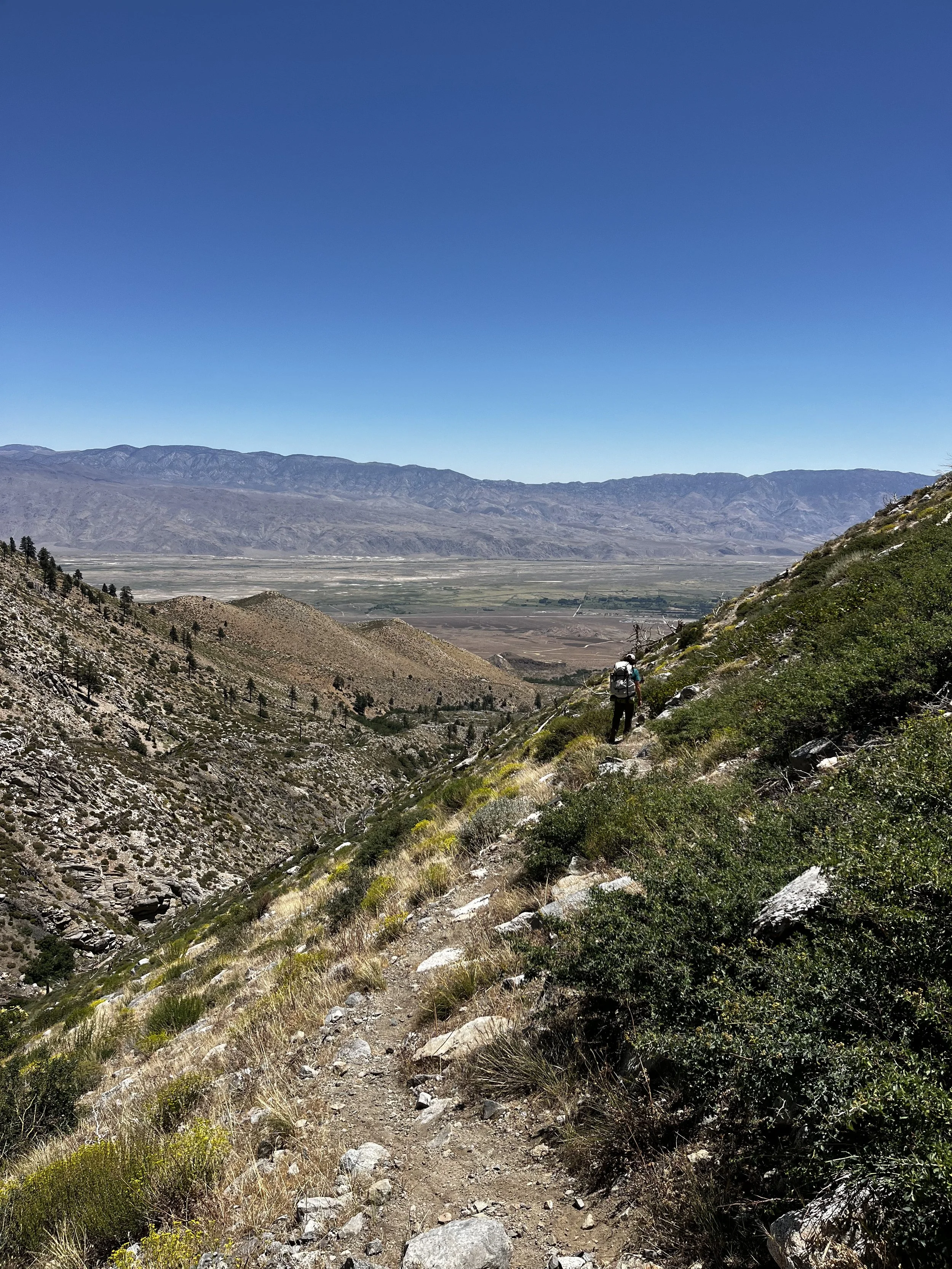
From the trailhead you hike for about a mile to the first of two crossings of the North Fork Oak Creek. There is little to no shade up to this point (hence the need for an early start). Being early July on an average snow year, the creek crossing was easy as the creek was already running low at this point of the season.
There are a lot of downed trees along the way to the second and final creek crossing. The final crossing was not a walk in the park. To start, the trail in not visible on the other side due to overgrowth. The water was running fast here and the rocks were slick. We ended up jumping across the creek where Tanner is standing in the photo below, which I barely cleared with a pack on (and would not recommend).
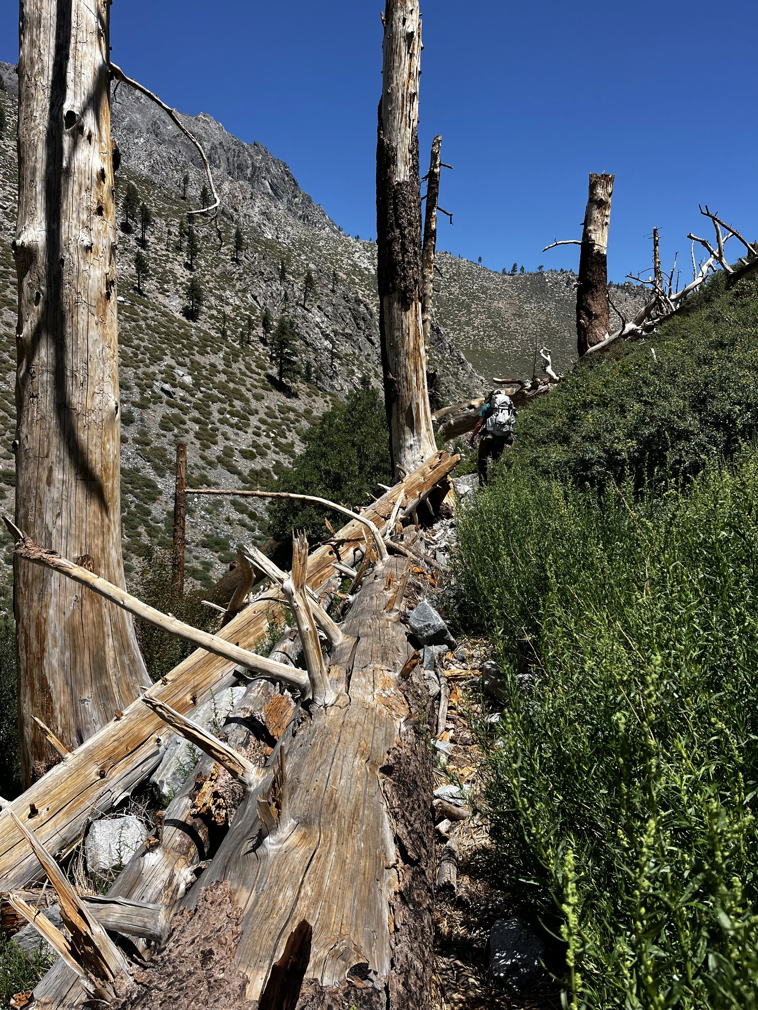

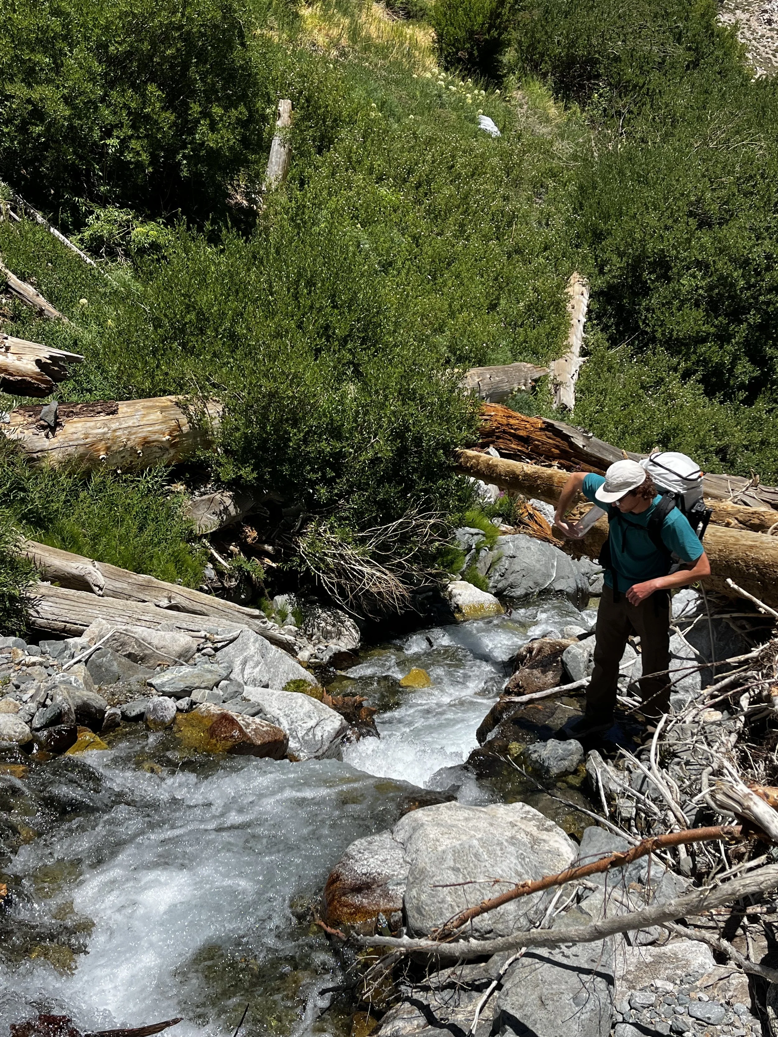
Once we safely crossed to the north side, we had to climb over a few more downed trees before we located the trail again which is buried in wild rose bushes. From here the “Ghost Trail” begins and attempts to make you cross the creek multiple times (remember you’ve already completed all your creek crossings) because the trail has been washed out. In this more gradual portion leading up to the final ascent to Baxter Pass, we also bushwhacked through a few sections of trail enshrouded in thorny shrub 5+ feet tall. The one upside of this maze of shrubbery is that you physically can’t lose the “trail” since your walled in by foliage on either side and there is only one way in and out.
We finally broke free from the shrubs and started our true ascent of Baxter Pass. Endless switchbacks through a mix of pact scree and talus lead you to the pass and a final push over a small sun cupped snowfield that clings to pass spit us out right at the pass signage.


The descent to Baxter Lakes from the pass is a piece of cake on the way down but is something to account for when hiking back out, the slope is unforgiving and the footing is loose.
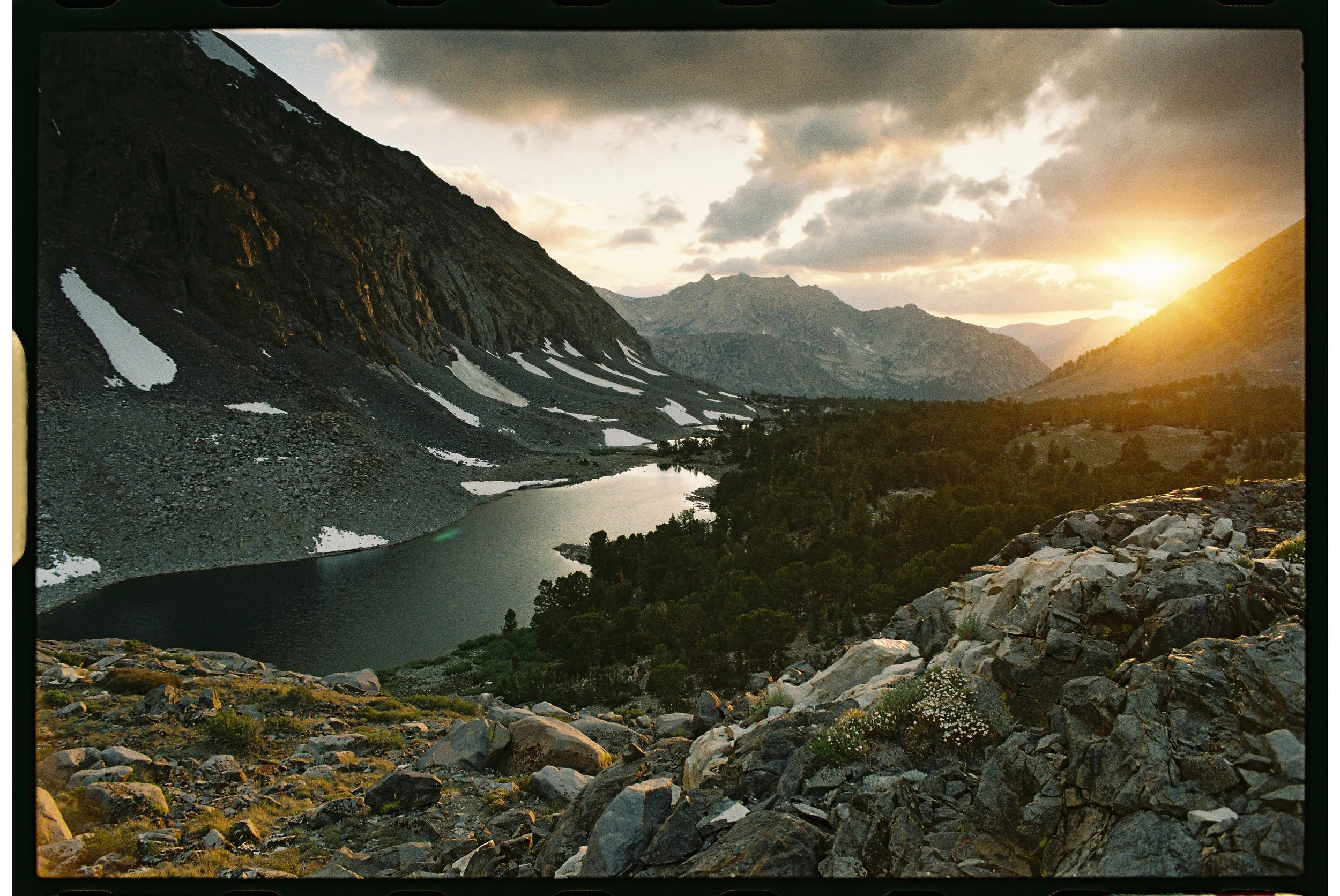
Our original objective was to camp at Dollar Lake night one but after a grueling hike in, we opted to camp near the largest of the Baxter Lakes. We promptly took a nap after setting up the tent and followed it with a lake dip to refresh. The sunset that night was a real treat.


Our aim for day two was to travel through Rae Lakes area and Sixty Lakes Basin and then go off-trail to camp in Gardiner Basin. We made our way down from the Baxter Lakes area to eventually link up with the John Muir Trail. Coming off a lesser used trail makes the JMT feel like a super highway with all the through hikers.
Once on the JMT, Dollar Lake beckoned us for another swim and we lingered with our snacks to take in the first views of Fin Dome. This stretch of trail between Dollar Lake and Rae Lakes is a feast for the eyes.


To get to the Sixty Lakes Basin Trail we had to ford the outlet of the uppermost Rae Lake. Shortly after crossing, we encountered the Rae Lakes backcountry ranger, the legendary Ranger Pilewski (check out this podcast episode about her 30 years serving the backcountry) and chatted with her about trail conditions.
We started making our way off trail towards southwest end of Sixty Lakes Basin Trail, aiming for Gardiner Basin, but the day and altitude had taken its toll and I convinced Tanner to camp at the largest lake in Sixty Lakes Basin instead and go explore Gardiner Basin the next day packless. A trail like Baxter for our first trip of the season had me feeling a little rusty.


An aside:
We noticed in Sixty Lakes Basin a strange rope system with bobbers tied to a rock in a few lakes. Perplexed, we made note of it to lookup later on and learned it was part of a Sierra Nevada yellow-legged frog reintroduction project. The park service sets out the nets to catch non-native trout that compete for resources with the endangered frog. It also might explain why the mosquitoes were so heinous at this lake in particular.
After starting off day three with breakfast and coffee, we loaded up our daypacks and made off for Gardiner Basin. We followed a use trail along the cliffs on the west end of the lake and it was straightforward off-trail hiking over gradual terrain from there to Sixty Lakes Col.
We ultimately decided to stay at the pass rather than venture into the basin. The views from the pass were beautiful and expansive but I was quite glad I hadn’t lugged my full pack up there as we had originally planned.


After returning to camp and packing up, we continued on a use trail to the northeast end of Sixty Lakes Basin to explore taking an off-trail pass called “Basin Notch” (10,720+ feet) to shorten our return to Baxter Lakes area. After eating lunch at the base of this notch and deciding it looked like an easy Class 1 pass, we started out ascent of “Basin Notch”. Besides a little scree skiing on the east side, it was easy going. The notch spit us out at Arrowhead Lake instead of having to backtrack through all of Sixty Lakes Basin Trail and through Rae Lakes onto the JMT. We hiked back to our night one campsite and rested up.


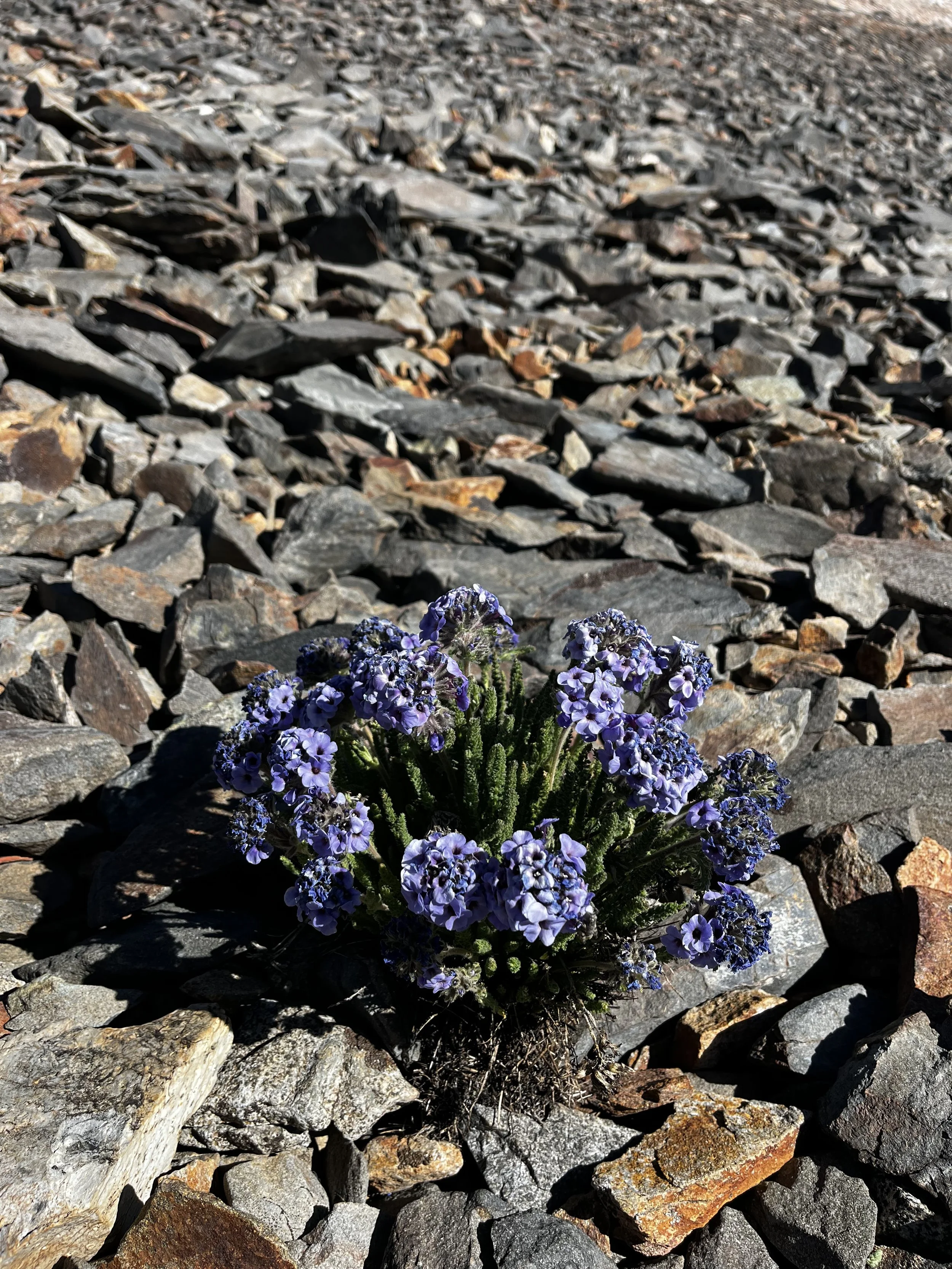
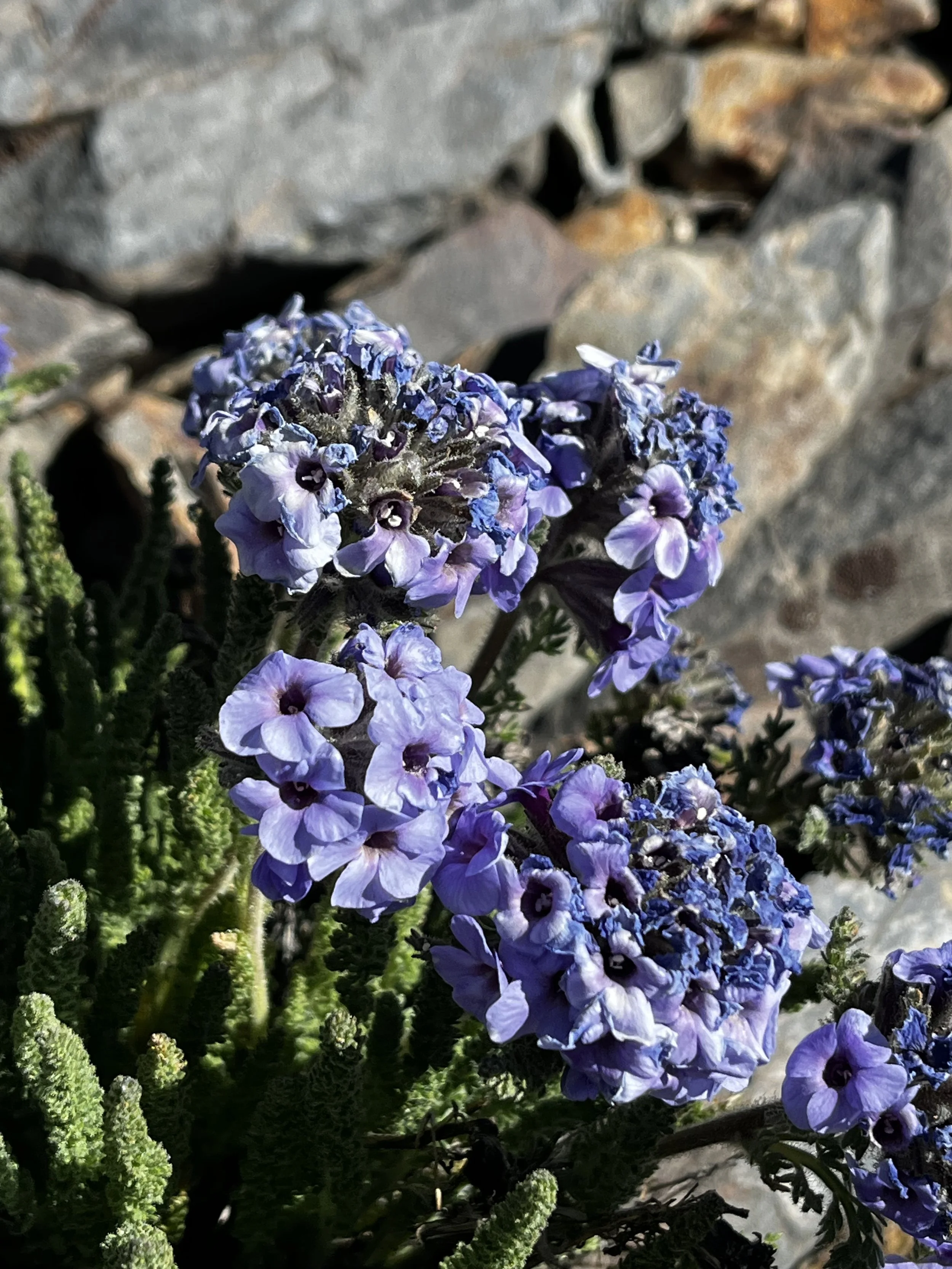
On our last morning, we got an early start and slogged up to Baxter Pass. Our reward was spotting a favorite wildflower of mine, the sky pilot (Polemonium eximium) amongst the black metamorphic rock on our climb. At the pass we chatted with a group that excitingly told us about spotting some bighorn sheep the day before but we were unfortunately not so lucky this trip.
The trail was much easier to follow on the hike out now that we knew the nuances. Overall, it was a beautiful trip and definitely not the worst of the Four Nastys (Sawmill still takes the cake).

Elevation profile of the route.